 |
|
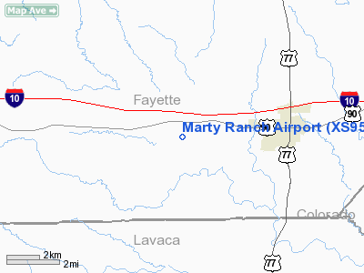
Location & QuickFacts
| FAA Information Effective: | 2008-09-25 |
| Airport Identifier: | XS95 |
| Airport Status: | Operational |
| Longitude/Latitude: | 096-58-13.9380W/29-40-36.8410N
-96.970538/29.676900 (Estimated) |
| Elevation: | 365 ft / 111.25 m (Estimated) |
| Land: | 0 acres |
| From nearest city: | 3 nautical miles W of Schulenburg, TX |
| Location: | Fayette County, TX |
| Magnetic Variation: | 07E (1985) |
Owner & Manager
| Ownership: | Privately owned |
| Owner: | Claude J Marty Jr |
| Address: | Rt 3 Box 300
Schulenburg, TX 78956 |
| Phone number: | 409-561-8446 |
| Manager: | Claude J. Marty, Jr. |
| Address: | Rt 3 Box 300
Schulenburg, TX 78956 |
| Phone number: | 409-561-8446 |
Airport Operations and Facilities
| Airport Use: | Private |
| Wind indicator: | Yes |
| Segmented Circle: | No |
| Control Tower: | No |
| Lighting Schedule: | PHONE REQ
FOR RWY LGTS AND RTG BCN, CALL 409-561-8446 (RES). |
| Beacon Color: | Clear (unlighted land airport) |
| Landing fee charge: | No |
| Sectional chart: | Houston |
| Region: | ASW - Southwest |
| Boundary ARTCC: | ZHU - Houston |
| Tie-in FSS: | CXO - Montgomery County |
| FSS on Airport: | No |
| FSS Toll Free: | 1-800-WX-BRIEF |
Airport Services
| Airframe Repair: | NONE |
| Power Plant Repair: | NONE |
Runway Information
Runway 15/33
| Dimension: | 2300 x 175 ft / 701.0 x 53.3 m |
| Surface: | TURF, |
| Edge Lights: | Low |
| |
Runway 15 |
Runway 33 |
| Traffic Pattern: | Left | Left |
|
Radio Navigation Aids
| ID |
Type |
Name |
Ch |
Freq |
Var |
Dist |
| OKT | NDB | Yoakum | | 350.00 | 06E | 23.6 nm |
| GYB | NDB | Lee County | | 385.00 | 07E | 29.6 nm |
| BNH | NDB | Brenham | | 362.00 | 06E | 45.2 nm |
| ARM | NDB | Wharton | | 245.00 | 06E | 49.8 nm |
| ELA | VOR/DME | Eagle Lake | 111X | 116.40 | 08E | 34.1 nm |
| VCT | VOR/DME | Victoria | 027X | 109.00 | 06E | 46.7 nm |
| IDU | VORTAC | Industry | 039X | 110.20 | 08E | 27.1 nm |
Remarks
Images and information placed above are from
http://www.airport-data.com/airport/XS95/
We thank them for the data!
| General Info
|
| Country |
United States
|
| State |
TEXAS
|
| FAA ID |
XS95
|
| Latitude |
29-40-36.841N
|
| Longitude |
096-58-13.938W
|
| Elevation |
365 feet
|
| Near City |
SCHULENBURG
|
We don't guarantee the information is fresh and accurate. The data may
be wrong or outdated.
For more up-to-date information please refer to other sources.
|
|


