 |
|
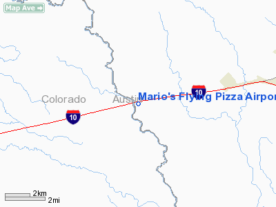
Mario's Flying Pizza Airport |
Location & QuickFacts
| FAA Information Effective: | 2008-09-25 |
| Airport Identifier: | 2TA4 |
| Airport Status: | Operational |
| Longitude/Latitude: | 096-17-33.8740W/29-44-51.8410N
-96.292743/29.747734 (Estimated) |
| Elevation: | 233 ft / 71.02 m (Estimated) |
| Land: | 0 acres |
| From nearest city: | 10 nautical miles N of Sealy, TX |
| Location: | Austin County, TX |
| Magnetic Variation: | 06E (1985) |
Owner & Manager
| Ownership: | Privately owned |
| Owner: | Rosy Bonaccorso |
| Address: | P.o. Box 427
Sealy, TX 77474 |
| Phone number: | 979-885-6783 |
| Manager: | Rosy Bonaccorso
OR SAL BONACCORSO AT PHONE 321-446-0055. |
| Address: | P.o. Box 427
Sealy, TX 77474 |
| Phone number: | 832-814-7668 |
Airport Operations and Facilities
| Airport Use: | Private |
| Segmented Circle: | No |
| Control Tower: | No |
| Sectional chart: | Houston |
| Region: | ASW - Southwest |
| Boundary ARTCC: | ZHU - Houston |
| Tie-in FSS: | CXO - Montgomery County |
| FSS on Airport: | No |
| FSS Toll Free: | 1-800-WX-BRIEF |
Runway Information
Runway 04/22
| Dimension: | 2050 x 40 ft / 624.8 x 12.2 m |
| Surface: | TURF, |
| |
Runway 04 |
Runway 22 |
| Traffic Pattern: | Left | Left |
|
Radio Navigation Aids
| ID |
Type |
Name |
Ch |
Freq |
Var |
Dist |
| BNH | NDB | Brenham | | 362.00 | 06E | 28.8 nm |
| ARM | NDB | Wharton | | 245.00 | 06E | 30.5 nm |
| LYD | NDB | Lakeside | | 249.00 | 05E | 32.4 nm |
| SGR | NDB | Hull | | 388.00 | 05E | 34.0 nm |
| EYQ | NDB | Weiser | | 286.00 | 06E | 35.8 nm |
| GYB | NDB | Lee County | | 385.00 | 07E | 43.8 nm |
| DWH | NDB | David Hooks | | 521.00 | 05E | 44.1 nm |
| SYG | NDB | Sandy Point | | 402.00 | 05E | 45.5 nm |
| ELA | VOR/DME | Eagle Lake | 111X | 116.40 | 08E | 5.3 nm |
| IDU | VORTAC | Industry | 039X | 110.20 | 08E | 18.8 nm |
| TNV | VORTAC | Navasota | 106X | 115.90 | 08E | 34.7 nm |
Images and information placed above are from
http://www.airport-data.com/airport/2TA4/
We thank them for the data!
| General Info
|
| Country |
United States
|
| State |
TEXAS
|
| FAA ID |
2TA4
|
| Latitude |
29-44-51.841N
|
| Longitude |
096-17-33.874W
|
| Elevation |
233 feet
|
| Near City |
SEALY
|
We don't guarantee the information is fresh and accurate. The data may
be wrong or outdated.
For more up-to-date information please refer to other sources.
|
|


