 |
|
Location & QuickFacts
| FAA Information Effective: | 2008-09-25 |
| Airport Identifier: | 98XS |
| Airport Status: | Operational |
| Longitude/Latitude: | 097-56-05.8000W/30-27-35.7000N
-97.934944/30.459917 (Estimated) |
| Elevation: | 800 ft / 243.84 m (Estimated) |
| Land: | 0 acres |
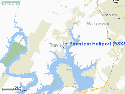
| From nearest city: | 1 nautical miles S of Jamestown, TX |
| Location: | Travis County, TX |
| Magnetic Variation: | () |
Owner & Manager
| Ownership: | Privately owned |
| Owner: | Thomas A. Rosenberger |
| Address: | 17713 North St.
Lago Vista, TX 78645 |
| Phone number: | 512-267-4581 |
| Address: |
|
Airport Operations and Facilities
| Airport Use: | Private |
| Control Tower: | No |
| Sectional chart: | San Antonio |
| Region: | ASW - Southwest |
| Boundary ARTCC: | ZHU - Houston |
| Tie-in FSS: | SJT - San Angelo |
| FSS Toll Free: | 1-800-WX-BRIEF |
Runway Information
Helipad H1
| Dimension: | 25 x 25 ft / 7.6 x 7.6 m |
| Surface: | ASPH, |
| |
Runway H1 |
Runway |
| Traffic Pattern: | Left | Left |
|
Radio Navigation Aids
| ID |
Type |
Name |
Ch |
Freq |
Var |
Dist |
| GUO | NDB | Georgetown | | 332.00 | 06E | 18.9 nm |
| MFS | NDB | Horseshoe Bay Resort | | 403.00 | 07E | 22.2 nm |
| BMQ | NDB | Burnet | | 341.00 | 07E | 23.0 nm |
| IL | NDB | Iresh | | 278.00 | 07E | 35.9 nm |
| HLR | NDB | Hood | | 347.00 | 07E | 41.8 nm |
| GR | NDB | Starn | | 323.00 | 07E | 42.7 nm |
| GRK | VOR/DME | Gray | 055X | 111.80 | 07E | 35.0 nm |
| CWK | VORTAC | Centex | 075X | 112.80 | 06E | 21.6 nm |
| STV | VORTAC | Stonewall | 085X | 113.80 | 08E | 42.8 nm |
| LZZ | VORTAC | Lampasas | 072X | 112.50 | 08E | 44.9 nm |
| LLO | VORTAC | Llano | 019X | 108.20 | 08E | 48.5 nm |
Remarks
- PRVDD THE PLINE ON THE WESTERN EDGE OF THE PAD IS EITHER REMOVED OR MARKED WITH ORANGE BALLS.
Images and information placed above are from
http://www.airport-data.com/airport/98XS/
We thank them for the data!
| General Info
|
| Country |
United States
|
| State |
TEXAS
|
| FAA ID |
98XS
|
| Latitude |
30-37-30.735N
|
| Longitude |
094-23-35.703W
|
| Elevation |
170 feet
|
| Near City |
WARREN
|
We don't guarantee the information is fresh and accurate. The data may
be wrong or outdated.
For more up-to-date information please refer to other sources.
|
|


