 |
|
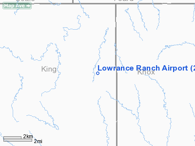
Location & QuickFacts
| FAA Information Effective: | 2008-09-25 |
| Airport Identifier: | 26TX |
| Airport Status: | Operational |
| Longitude/Latitude: | 100-01-04.3600W/33-45-53.3060N
-100.017878/33.764807 (Estimated) |
| Elevation: | 1692 ft / 515.72 m (Estimated) |
| Land: | 0 acres |
| From nearest city: | 10 nautical miles W of Truscott, TX |
| Location: | King County, TX |
| Magnetic Variation: | 08E (1985) |
Owner & Manager
| Ownership: | Privately owned |
| Owner: | Ed Lowrance |
| Address: | 1208 Alamo Nat'l Bank Bldg
San Antonio, TX 78205 |
| Phone number: | 817-474-3235 |
| Manager: | Eddie Lowrance |
| Address: | Lowrance Ranch
Truscott, TX 79260 |
| Phone number: | 817-474-3318 |
Airport Operations and Facilities
| Airport Use: | Private |
| Wind indicator: | Yes |
| Segmented Circle: | No |
| Control Tower: | No |
| Landing fee charge: | No |
| Sectional chart: | Dallas-ft Worth |
| Region: | ASW - Southwest |
| Boundary ARTCC: | ZFW - Fort Worth |
| Tie-in FSS: | FTW - Fort Worth |
| FSS on Airport: | No |
| FSS Phone: | 817-541-3474 |
| FSS Toll Free: | 1-800-WX-BRIEF |
Airport Services
| Airframe Repair: | NONE |
| Power Plant Repair: | NONE |
Runway Information
Runway 03/21
| Dimension: | 1600 x 50 ft / 487.7 x 15.2 m |
| Surface: | TURF, |
| |
Runway 03 |
Runway 21 |
| Traffic Pattern: | Left | Left |
|
Runway 17/35
| Dimension: | 2160 x 50 ft / 658.4 x 15.2 m |
| Surface: | TURF, |
| |
Runway 17 |
Runway 35 |
| Traffic Pattern: | Left | Left |
|
Radio Navigation Aids
| ID |
Type |
Name |
Ch |
Freq |
Var |
Dist |
| AKL | NDB | Haskell | | 407.00 | 08E | 37.6 nm |
| VRT | NDB | Wilbarger | | 230.00 | 08E | 46.1 nm |
| GTH | VORTAC | Guthrie | 092X | 114.50 | 10E | 15.9 nm |
| CDS | VORTAC | Childress | 123X | 117.60 | 10E | 38.7 nm |
Remarks
- 300' MICROWAVE TWR 1MI W OF STRIP.
- OCCASIONALLY CATTLE ON RWYS.
Images and information placed above are from
http://www.airport-data.com/airport/26TX/
We thank them for the data!
| General Info
|
| Country |
United States
|
| State |
TEXAS
|
| FAA ID |
26TX
|
| Latitude |
33-45-53.306N
|
| Longitude |
100-01-04.360W
|
| Elevation |
1692 feet
|
| Near City |
TRUSCOTT
|
We don't guarantee the information is fresh and accurate. The data may
be wrong or outdated.
For more up-to-date information please refer to other sources.
|
|


