 |
|
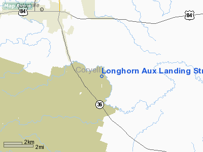
Longhorn Aux Landing Strip Airport |
Location & QuickFacts
| FAA Information Effective: | 2008-09-25 |
| Airport Identifier: | 22XS |
| Airport Status: | Operational |
| Longitude/Latitude: | 097-40-01.0700W/31-22-15.6010N
-97.666964/31.371000 (Estimated) |
| Elevation: | 720 ft / 219.46 m (Estimated) |
| Land: | 0 acres |
| From nearest city: | 6 nautical miles NW of Fort Hood(killeen), TX |
| Location: | Bell County, TX |
| Magnetic Variation: | 06E (1995) |
Owner & Manager
| Ownership: | Army owned |
| Owner: | Unknown |
| Address: |
|
| Manager: | Unknown |
| Address: |
|
Airport Operations and Facilities
| Airport Use: | Private |
| Segmented Circle: | No |
| Control Tower: | No |
| Sectional chart: | San Antonio |
| Region: | ASW - Southwest |
| Boundary ARTCC: | ZFW - Fort Worth |
| Tie-in FSS: | SJT - San Angelo |
| FSS on Airport: | No |
| FSS Toll Free: | 1-800-WX-BRIEF |
Runway Information
Runway 15/33
| Dimension: | 3488 x 75 ft / 1063.1 x 22.9 m |
| Surface: | ASPH, |
| |
Runway 15 |
Runway 33 |
| Traffic Pattern: | Left | Left |
|
Radio Navigation Aids
| ID |
Type |
Name |
Ch |
Freq |
Var |
Dist |
| HLR | NDB | Hood | | 347.00 | 07E | 14.7 nm |
| GR | NDB | Starn | | 323.00 | 07E | 16.3 nm |
| IL | NDB | Iresh | | 278.00 | 07E | 21.0 nm |
| MNZ | NDB | Hamilton | | 251.00 | 07E | 28.8 nm |
| ROB | NDB | Robinson | | 400.00 | 07E | 31.7 nm |
| GUO | NDB | Georgetown | | 332.00 | 06E | 41.3 nm |
| BMQ | NDB | Burnet | | 341.00 | 07E | 47.9 nm |
| TPL | VOR/DME | Temple | 041X | 110.40 | 09E | 15.8 nm |
| GRK | VOR/DME | Gray | 055X | 111.80 | 07E | 21.7 nm |
| LZZ | VORTAC | Lampasas | 072X | 112.50 | 08E | 26.8 nm |
| ACT | VORTAC | Waco | 100X | 115.30 | 09E | 26.9 nm |
| JEN | VORTAC | Glen Rose | 097X | 115.00 | 06E | 48.6 nm |
Images and information placed above are from
http://www.airport-data.com/airport/22XS/
We thank them for the data!
| General Info
|
| Country |
United States
|
| State |
TEXAS
|
| FAA ID |
22XS
|
| Latitude |
31-22-15.601N
|
| Longitude |
097-40-01.070W
|
| Elevation |
720 feet
|
| Near City |
FORT HOOD(KILLEEN)
|
We don't guarantee the information is fresh and accurate. The data may
be wrong or outdated.
For more up-to-date information please refer to other sources.
|
|


