 |
|
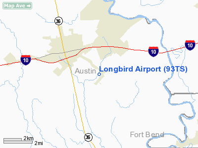
Location & QuickFacts
| FAA Information Effective: | 2008-09-25 |
| Airport Identifier: | 93TS |
| Airport Status: | Operational |
| Longitude/Latitude: | 096-06-52.8550W/29-44-53.8400N
-96.114682/29.748289 (Estimated) |
| Elevation: | 150 ft / 45.72 m (Estimated) |
| Land: | 300 acres |
| From nearest city: | 2 nautical miles SW of Sealy, TX |
| Location: | Austin County, TX |
| Magnetic Variation: | 06E (1985) |
Owner & Manager
| Ownership: | Privately owned |
| Owner: | Susan & Sandy Phillips |
| Address: | 274 Ward Bend Rd
Sealy, TX 77474 |
| Phone number: | 409-885-6300 |
| Manager: | Susan Phillips |
| Address: | 274 Ward Bend Rd
Sealy, TX 77474 |
| Phone number: | 409-885-6777 |
Airport Operations and Facilities
| Airport Use: | Private |
| Wind indicator: | Yes |
| Segmented Circle: | No |
| Control Tower: | No |
| Sectional chart: | Houston |
| Region: | ASW - Southwest |
| Boundary ARTCC: | ZHU - Houston |
| Tie-in FSS: | CXO - Montgomery County |
| FSS Toll Free: | 1-800-WX-BRIEF |
Runway Information
Runway 09/27
| Dimension: | 2550 x 150 ft / 777.2 x 45.7 m |
| Surface: | TURF, |
| |
Runway 09 |
Runway 27 |
| Traffic Pattern: | Left | Left |
| Obstruction: | | 30 ft pline, 30.0 ft from runway |
|
Runway 18/36
| Dimension: | 3500 x 100 ft / 1066.8 x 30.5 m |
| Surface: | TURF, |
| |
Runway 18 |
Runway 36 |
| Traffic Pattern: | Left | Left |
| Obstruction: | | 30 ft trees, 30.0 ft from runway |
|
Radio Navigation Aids
| ID |
Type |
Name |
Ch |
Freq |
Var |
Dist |
| LYD | NDB | Lakeside | | 249.00 | 05E | 23.2 nm |
| SGR | NDB | Hull | | 388.00 | 05E | 24.9 nm |
| EYQ | NDB | Weiser | | 286.00 | 06E | 27.1 nm |
| ARM | NDB | Wharton | | 245.00 | 06E | 29.7 nm |
| BNH | NDB | Brenham | | 362.00 | 06E | 31.5 nm |
| DWH | NDB | David Hooks | | 521.00 | 05E | 36.5 nm |
| SYG | NDB | Sandy Point | | 402.00 | 05E | 36.9 nm |
| BYY | NDB | Bay City | | 344.00 | 06E | 48.5 nm |
| BVP | NDB | Nixin | | 326.00 | 05E | 49.2 nm |
| ELA | VOR/DME | Eagle Lake | 111X | 116.40 | 08E | 11.8 nm |
| HUB | VOR/DME | Hobby | 118X | 117.10 | 05E | 44.1 nm |
| IDU | VORTAC | Industry | 039X | 110.20 | 08E | 26.5 nm |
| TNV | VORTAC | Navasota | 106X | 115.90 | 08E | 32.6 nm |
| IAH | VORTAC | Humble | 113X | 116.60 | 05E | 42.0 nm |
| HOU | VOT | Houston Wm P Hobby | | 108.40 | | 44.1 nm |
Images and information placed above are from
http://www.airport-data.com/airport/93TS/
We thank them for the data!
| General Info
|
| Country |
United States
|
| State |
TEXAS
|
| FAA ID |
93TS
|
| Latitude |
29-44-53.840N
|
| Longitude |
096-06-52.855W
|
| Elevation |
150 feet
|
| Near City |
SEALY
|
We don't guarantee the information is fresh and accurate. The data may
be wrong or outdated.
For more up-to-date information please refer to other sources.
|
|


