 |
|
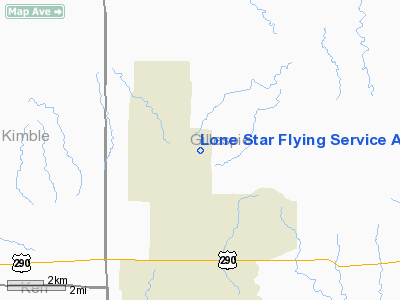
Lone Star Flying Service Airport |
Location & QuickFacts
| FAA Information Effective: | 2008-09-25 |
| Airport Identifier: | XA41 |
| Airport Status: | Operational |
| Longitude/Latitude: | 099-14-51.1200W/30-21-18.0600N
-99.247533/30.355017 (Estimated) |
| Elevation: | 2220 ft / 676.66 m (Estimated) |
| Land: | 0 acres |
| From nearest city: | 2 nautical miles N of Harper, TX |
| Location: | Gillespie County, TX |
| Magnetic Variation: | () |
Owner & Manager
| Ownership: | Privately owned |
| Owner: | Thomas D. Taylor |
| Address: | 724 Dynamite Trail
Harper, TX 78631 |
| Phone number: | 830-739-2500 |
| Manager: | Thomas D. Taylor |
| Address: | 724 Dynamite Trail
Harper, TX 78631 |
| Phone number: | 830-739-2500 |
Airport Operations and Facilities
| Airport Use: | Private |
| Wind indicator: | Yes |
| Control Tower: | No |
| Sectional chart: | San Antonio |
| Region: | ASW - Southwest |
| Boundary ARTCC: | ZHU - Houston |
| Tie-in FSS: | SJT - San Angelo |
| FSS Toll Free: | 1-800-WX-BRIEF |
Runway Information
Runway 14/32
| Dimension: | 3700 x 60 ft / 1127.8 x 18.3 m |
| Surface: | TURF, |
| |
Runway 14 |
Runway 32 |
| Traffic Pattern: | Left | Left |
|
Radio Navigation Aids
| ID |
Type |
Name |
Ch |
Freq |
Var |
Dist |
| ER | NDB | Shein | | 263.00 | 08E | 29.2 nm |
| MFS | NDB | Horseshoe Bay Resort | | 403.00 | 07E | 47.2 nm |
| BBD | NDB | Brady | | 380.00 | 07E | 49.6 nm |
| CSI | VORTAC | Center Point | 122X | 117.50 | 08E | 26.1 nm |
| STV | VORTAC | Stonewall | 085X | 113.80 | 08E | 29.5 nm |
| JCT | VORTAC | Junction | 107X | 116.00 | 08E | 32.9 nm |
| LLO | VORTAC | Llano | 019X | 108.20 | 08E | 35.6 nm |
Images and information placed above are from
http://www.airport-data.com/airport/XA41/
We thank them for the data!
|
|


