 |
|
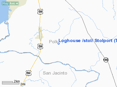
Loghouse /stol/ Stolport Airport |
Location & QuickFacts
| FAA Information Effective: | 2008-09-25 |
| Airport Identifier: | TE38 |
| Airport Status: | Operational |
| Longitude/Latitude: | 094-54-33.7570W/30-35-33.7220N
-94.909377/30.592701 (Estimated) |
| Elevation: | 184 ft / 56.08 m (Estimated) |
| Land: | 127 acres |
| From nearest city: | 3 nautical miles E of Goodrich, TX |
| Location: | Polk County, TX |
| Magnetic Variation: | 06E (1985) |
Owner & Manager
| Ownership: | Privately owned |
| Owner: | James Bergman |
| Address: | 709 N Tyler
Livingston, TX 77351 |
| Phone number: | 903-561-4644 |
| Manager: | Harry Bergman |
| Address: | Po Box 7998
Tyler, TX 75711 |
| Phone number: | 903-839-2557 |
Airport Operations and Facilities
| Airport Use: | Private |
| Wind indicator: | Yes |
| Segmented Circle: | No |
| Control Tower: | No |
| Sectional chart: | Houston |
| Region: | ASW - Southwest |
| Boundary ARTCC: | ZHU - Houston |
| Tie-in FSS: | DRI - De Ridder |
| FSS Toll Free: | 1-800-WX-BRIEF |
Runway Information
Runway 12/30
| Dimension: | 1600 x 30 ft / 487.7 x 9.1 m |
| Surface: | TURF, |
| |
Runway 12 |
Runway 30 |
| Traffic Pattern: | Left | Left |
| Obstruction: | 50 ft trees, 1000.0 ft from runway | 50 ft trees, 1000.0 ft from runway |
|
Radio Navigation Aids
| ID |
Type |
Name |
Ch |
Freq |
Var |
Dist |
| UTS | NDB | Huntsville | | 308.00 | 06E | 36.3 nm |
| HRD | NDB | Hardin County | | 524.00 | 04E | 37.0 nm |
| BVP | NDB | Nixin | | 326.00 | 05E | 39.4 nm |
| DWH | NDB | David Hooks | | 521.00 | 05E | 44.1 nm |
| GDE | NDB | Goodhue | | 368.00 | 07E | 48.3 nm |
| DAS | VORTAC | Daisetta | 116X | 116.90 | 05E | 27.8 nm |
| LFK | VORTAC | Lufkin | 058X | 112.10 | 05E | 35.7 nm |
| IAH | VORTAC | Humble | 113X | 116.60 | 05E | 44.4 nm |
Images and information placed above are from
http://www.airport-data.com/airport/TE38/
We thank them for the data!
| General Info
|
| Country |
United States
|
| State |
TEXAS
|
| FAA ID |
TE38
|
| Latitude |
30-35-33.722N
|
| Longitude |
094-54-33.757W
|
| Elevation |
184 feet
|
| Near City |
GOODRICH
|
We don't guarantee the information is fresh and accurate. The data may
be wrong or outdated.
For more up-to-date information please refer to other sources.
|
|


