 |
|
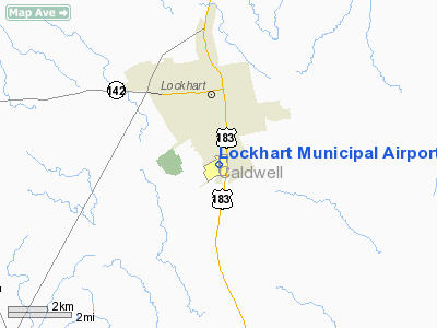
Location & QuickFacts
| FAA Information Effective: | 2008-09-25 |
| Airport Identifier: | 50R |
| Airport Status: | Operational |
| Longitude/Latitude: | 097-40-20.7000W/29-51-01.2000N
-97.672417/29.850333 (Estimated) |
| Elevation: | 532 ft / 162.15 m (Surveyed) |
| Land: | 65 acres |
| From nearest city: | 2 nautical miles S of Lockhart, TX |
| Location: | Caldwell County, TX |
| Magnetic Variation: | 07E (1985) |
Owner & Manager
| Ownership: | Publicly owned |
| Owner: | City Of Lockhart |
| Address: | Po Box 239
Lockhart, TX 78644 |
| Phone number: | 512-398-3461 |
| Manager: | Vance Rogers |
| Address: | Po Box 239
Lockhart, TX 78644 |
| Phone number: | 512-398-6452 |
Airport Operations and Facilities
| Airport Use: | Open to public |
| Wind indicator: | Yes |
| Segmented Circle: | Yes |
| Control Tower: | No |
| Lighting Schedule: | DUSK-DAWN
MIRL RY 18/36 PRESET LOW INTST; TO INCR INTST ACTVT - CTAF. |
| Beacon Color: | Clear-Green (lighted land airport) |
| Landing fee charge: | No |
| Sectional chart: | San Antonio |
| Region: | ASW - Southwest |
| Boundary ARTCC: | ZHU - Houston |
| Tie-in FSS: | SJT - San Angelo |
| FSS on Airport: | No |
| FSS Toll Free: | 1-800-WX-BRIEF |
| NOTAMs Facility: | SJT (NOTAM-d service avaliable) |
| Federal Agreements: | NGY |
Airport Communications
| CTAF: | 122.800 |
| Unicom: | 122.800 |
Airport Services
| Fuel available: | 100LL |
| Bulk Oxygen: | NONE |
Runway Information
Runway 18/36
| Dimension: | 4001 x 75 ft / 1219.5 x 22.9 m |
| Surface: | ASPH, Good Condition |
| Weight Limit: | Single wheel: 12500 lbs. |
| Edge Lights: | Medium |
| |
Runway 18 |
Runway 36 |
| Longitude: | 097-40-19.9057W | 097-40-21.4624W |
| Latitude: | 29-51-20.9768N | 29-50-41.3923N |
| Elevation: | 532.00 ft | 524.00 ft |
| Alignment: | 127 | 2 |
| Traffic Pattern: | Left | Left |
| Markings: | Non-precision instrument, Good Condition | Non-precision instrument, Good Condition |
| Crossing Height: | 24.00 ft | 25.00 ft |
| VASI: | 2-light PAPI on left side | 2-light PAPI on left side |
| Visual Glide Angle: | 3.50° | 3.00° |
| Obstruction: | , 50:1 slope to clear | 10 ft tree, 367.0 ft from runway, 90 ft left of centerline, 16:1 slope to clear |
|
Radio Navigation Aids
| ID |
Type |
Name |
Ch |
Freq |
Var |
Dist |
| GYB | NDB | Lee County | | 385.00 | 07E | 40.9 nm |
| OKT | NDB | Yoakum | | 350.00 | 06E | 42.7 nm |
| DHK | TACAN | Randolph | 036X | | 09E | 36.3 nm |
| CWK | VORTAC | Centex | 075X | 112.80 | 06E | 32.6 nm |
| RND | VORTAC | Randolph | 70X | 112.30 | 09E | 37.7 nm |
| SAT | VORTAC | San Antonio | 115X | 116.80 | 08E | 43.0 nm |
| SAT | VOT | San Antonio Intl | | 110.40 | | 45.8 nm |
Remarks
- +280' LGTD MICROWAVE TOWER 10,560' FM RY 36 THR ON CNTRLN.
- PARALLEL TWY HAS GREEN CNTRLN REFLECTORS.
- PRE DATES THE ACT.
Images and information placed above are from
http://www.airport-data.com/airport/50R/
We thank them for the data!
| General Info
|
| Country |
United States
|
| State |
TEXAS
|
| FAA ID |
50R
|
| Latitude |
29-51-01.200N
|
| Longitude |
097-40-20.700W
|
| Elevation |
532 feet
|
| Near City |
LOCKHART
|
We don't guarantee the information is fresh and accurate. The data may
be wrong or outdated.
For more up-to-date information please refer to other sources.
|
|


