 |
|
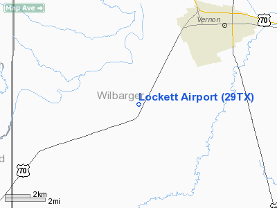
Location & QuickFacts
| FAA Information Effective: | 2008-09-25 |
| Airport Identifier: | 29TX |
| Airport Status: | Operational |
| Longitude/Latitude: | 099-21-56.2980W/34-05-40.3100N
-99.365638/34.094531 (Estimated) |
| Elevation: | 1282 ft / 390.75 m (Surveyed) |
| Land: | 10 acres |
| From nearest city: | 5 nautical miles SW of Vernon, TX |
| Location: | Wilbarger County, TX |
| Magnetic Variation: | 08E (1985) |
Owner & Manager
| Ownership: | Privately owned |
| Owner: | Hardcastle Ag Air |
| Address: | Box 1614
Vernon, TX 76384 |
| Phone number: | 817-552-9591 |
| Manager: | Hj Hardcastle |
| Address: | Box 1614
Vernon, TX 76380 |
| Phone number: | 817-552-9591 |
Airport Operations and Facilities
| Airport Use: | Private |
| Wind indicator: | Yes |
| Segmented Circle: | No |
| Control Tower: | No |
| Landing fee charge: | No |
| Sectional chart: | Dallas-ft Worth |
| Region: | ASW - Southwest |
| Boundary ARTCC: | ZFW - Fort Worth |
| Tie-in FSS: | FTW - Fort Worth |
| FSS on Airport: | No |
| FSS Phone: | 817-541-3474 |
| FSS Toll Free: | 1-800-WX-BRIEF |
Airport Services
| Fuel available: | A |
| Airframe Repair: | NONE |
| Power Plant Repair: | NONE |
| Bottled Oxygen: | NONE |
| Bulk Oxygen: | NONE |
Runway Information
Runway 15/33
| Dimension: | 3000 x 30 ft / 914.4 x 9.1 m |
| Surface: | ASPH, |
| |
Runway 15 |
Runway 33 |
| Traffic Pattern: | Left | Left |
| Runway End Identifier: | No | No |
| Centerline Lights: | No | No |
| Touchdown Lights: | No | No |
|
Radio Navigation Aids
| ID |
Type |
Name |
Ch |
Freq |
Var |
Dist |
| VRT | NDB | Wilbarger | | 230.00 | 08E | 9.0 nm |
| SKB | NDB | Scotland | | 344.00 | 08E | 47.5 nm |
| SHP | TACAN | Sheppard | 045X | | 10E | 44.2 nm |
| LTS | VORTAC | Altus | 035X | 109.80 | 08E | 34.5 nm |
| SPS | VORTAC | Wichita Falls | 074X | 112.70 | 10E | 39.0 nm |
| HBR | VORTAC | Hobart | 055X | 111.80 | 10E | 48.8 nm |
| CDS | VORTAC | Childress | 123X | 117.60 | 10E | 48.8 nm |
Remarks
- HVY AG OPNS DURG SPRING & SUMMER.
- 90' TOWER ON WEST SIDE OF BLDG SW OF SOUTH END OF RWY
- VFR USE ONLY, THRS DSPLCD TO MAINT 20:1 APCH SLOPES BOTH ENDS.
Images and information placed above are from
http://www.airport-data.com/airport/29TX/
We thank them for the data!
| General Info
|
| Country |
United States
|
| State |
TEXAS
|
| FAA ID |
29TX
|
| Latitude |
34-05-40.310N
|
| Longitude |
099-21-56.298W
|
| Elevation |
1282 feet
|
| Near City |
VERNON
|
We don't guarantee the information is fresh and accurate. The data may
be wrong or outdated.
For more up-to-date information please refer to other sources.
|
|


