 |
|
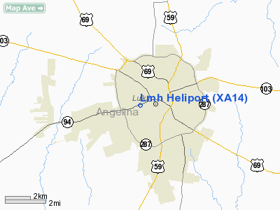
Location & QuickFacts
| FAA Information Effective: | 2008-09-25 |
| Airport Identifier: | XA14 |
| Airport Status: | Operational |
| Longitude/Latitude: | 094-44-38.1000W/31-20-11.1000N
-94.743917/31.336417 (Estimated) |
| Elevation: | 320 ft / 97.54 m (Estimated) |
| Land: | 0 acres |
| From nearest city: | 0 nautical miles N of Lufkin, TX |
| Location: | Angelina County, TX |
| Magnetic Variation: | () |
Owner & Manager
| Ownership: | Privately owned |
| Owner: | Memorial Health System Of East Tx |
| Address: | 1201 N Frank
Lufkin, TX 75904 |
| Phone number: | 936-639-7164 |
| Manager: | Dale E. Clark |
| Address: | 1201 N. Frank
Lufkin, TX 75904 |
| Phone number: | 936-639-7164 |
Airport Operations and Facilities
| Airport Use: | Private
MEDICAL. |
| Wind indicator: | Yes |
| Segmented Circle: | No |
| Control Tower: | No |
| Lighting Schedule: | PHONE REQ
FOR PERIMETER & FLOOD LGTS CALL 936-639-7164. |
| Sectional chart: | Houston |
| Region: | ASW - Southwest |
| Boundary ARTCC: | ZHU - Houston |
| Tie-in FSS: | CXO - Montgomery County |
| FSS Toll Free: | 1-800-WX-BRIEF |
Runway Information
Helipad H1
| Dimension: | 35 x 35 ft / 10.7 x 10.7 m |
| Surface: | CONC, Good Condition |
| |
Runway H1 |
Runway |
| Traffic Pattern: | Left | Left |
|
Radio Navigation Aids
| ID |
Type |
Name |
Ch |
Freq |
Var |
Dist |
| OC | NDB | Nados | | 253.00 | 05E | 9.0 nm |
| GXD | NDB | Nacogdoches | | 391.00 | 05E | 18.9 nm |
| JSO | NDB | Cherokee County | | 263.00 | 05E | 40.2 nm |
| CZJ | NDB | Amason | | 341.00 | 04E | 42.5 nm |
| JAS | NDB | Jasper | | 344.00 | 04E | 43.2 nm |
| LFK | VORTAC | Lufkin | 058X | 112.10 | 05E | 10.6 nm |
Images and information placed above are from
http://www.airport-data.com/airport/XA14/
We thank them for the data!
|
|


