 |
|
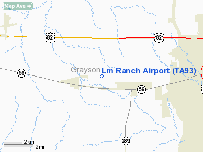
Location & QuickFacts
| FAA Information Effective: | 2008-09-25 |
| Airport Identifier: | TA93 |
| Airport Status: | Operational |
| Longitude/Latitude: | 096-44-00.8400W/33-37-59.9000N
-96.733567/33.633306 (Estimated) |
| Elevation: | 770 ft / 234.70 m (Estimated) |
| Land: | 0 acres |
| From nearest city: | 7 nautical miles E of Sherman, TX |
| Location: | Grayson County, TX |
| Magnetic Variation: | 05E (2000) |
Owner & Manager
| Ownership: | Privately owned |
| Owner: | Leldon Locke |
| Address: | 5074 Deaver Road
Sherman, TX 75092 |
| Phone number: | 903-893-1226 |
| Manager: | Leldon Locke |
| Address: | 5074 Deaver Road
Sherman, TX 75092 |
| Phone number: | 903-893-1226 |
Airport Operations and Facilities
| Airport Use: | Private |
| Segmented Circle: | No |
| Control Tower: | No |
| Sectional chart: | Dallas-ft Worth |
| Region: | ASW - Southwest |
| Boundary ARTCC: | ZFW - Fort Worth |
| Tie-in FSS: | FTW - Fort Worth |
| FSS Phone: | 817-541-3474 |
| FSS Toll Free: | 1-800-WX-BRIEF |
Runway Information
Runway 17/35
| Dimension: | 3000 x 50 ft / 914.4 x 15.2 m |
| Surface: | TURF, |
| |
Runway 17 |
Runway 35 |
| Traffic Pattern: | Left | Left |
|
Radio Navigation Aids
| ID |
Type |
Name |
Ch |
Freq |
Var |
Dist |
| DNI | NDB | Denison | | 341.00 | 06E | 11.9 nm |
| GLE | NDB | Gainesville | | 330.00 | 06E | 23.8 nm |
| DUA | NDB | Durant | | 359.00 | 05E | 25.0 nm |
| HJM | NDB | Rayburn | | 415.00 | 06E | 27.9 nm |
| AUV | NDB | Arbuckle | | 284.00 | 07E | 36.7 nm |
| MII | NDB | Caddo Mills | | 316.00 | 06E | 43.2 nm |
| MJF | TACAN | Arvilla | 033X | | 05E | 48.0 nm |
| URH | VOR/DME | Texoma | 090X | 114.30 | 05E | 25.3 nm |
| CVE | VOR/DME | Cowboy | 109X | 116.20 | 06E | 45.5 nm |
| TTT | VOR/DME | Maverick | 078X | 113.10 | 06E | 48.5 nm |
| BYP | VORTAC | Bonham | 093X | 114.60 | 06E | 25.7 nm |
| ADM | VORTAC | Ardmore | 114X | 116.70 | 06E | 41.0 nm |
| DAL | VOT | Dallas Love Field | | 113.30 | | 47.6 nm |
Remarks
- OWNER DESIRES ARPT NOT BE CHARTED.
- PRVDD VFR AND A CLEAR 20:1 APCH FOR BOTH ENDS OF RY.
Images and information placed above are from
http://www.airport-data.com/airport/TA93/
We thank them for the data!
| General Info
|
| Country |
United States
|
| State |
TEXAS
|
| FAA ID |
TA93
|
| Latitude |
33-37-59.900N
|
| Longitude |
096-44-00.840W
|
| Elevation |
770 feet
|
| Near City |
SHERMAN
|
We don't guarantee the information is fresh and accurate. The data may
be wrong or outdated.
For more up-to-date information please refer to other sources.
|
|


