 |
|
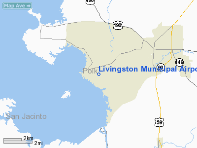
Location & QuickFacts
| FAA Information Effective: | 2008-09-25 |
| Airport Identifier: | 00R |
| Airport Status: | Operational |
| Longitude/Latitude: | 095-01-04.5400W/30-41-09.1000N
-95.017928/30.685861 (Estimated) |
| Elevation: | 151 ft / 46.02 m (Surveyed) |
| Land: | 63 acres |
| From nearest city: | 5 nautical miles SW of Livingston, TX |
| Location: | Polk County, TX |
| Magnetic Variation: | 06E (1985) |
Owner & Manager
| Ownership: | Publicly owned |
| Owner: | City Of Livingston |
| Address: | 200 West Church
Livingston, TX 77351 |
| Phone number: | 936-327-4311 |
| Manager: | Dan Burrows |
| Address: | 415 Airport Rd
Livingston, TX 77351 |
| Phone number: | 936-967-5858 |
Airport Operations and Facilities
| Airport Use: | Open to public |
| Wind indicator: | Yes |
| Segmented Circle: | Yes |
| Control Tower: | No |
| Lighting Schedule: | DUSK-DAWN |
| Beacon Color: | Clear-Green (lighted land airport) |
| Landing fee charge: | No |
| Sectional chart: | Houston |
| Region: | ASW - Southwest |
| Boundary ARTCC: | ZHU - Houston |
| Tie-in FSS: | CXO - Montgomery County |
| FSS on Airport: | No |
| FSS Toll Free: | 1-800-WX-BRIEF |
| NOTAMs Facility: | CXO (NOTAM-d service avaliable) |
| Federal Agreements: | NGY |
Airport Communications
| CTAF: | 122.700 |
| Unicom: | 122.700 |
Airport Services
| Fuel available: | 100LL |
| Airframe Repair: | MAJOR |
| Power Plant Repair: | MAJOR |
| Bottled Oxygen: | NONE |
| Bulk Oxygen: | NONE |
Runway Information
Runway 12/30
| Dimension: | 3700 x 60 ft / 1127.8 x 18.3 m |
| Surface: | ASPH, Good Condition |
| Weight Limit: | Single wheel: 11000 lbs. |
| Edge Lights: | Medium |
| |
Runway 12 |
Runway 30 |
| Longitude: | 095-01-20.6500W | 095-00-48.4600W |
| Latitude: | 30-41-21.0000N | 30-40-57.1800N |
| Elevation: | 150.00 ft | 150.00 ft |
| Alignment: | 127 | 127 |
| Traffic Pattern: | Left | Left |
| Markings: | Non-precision instrument, Good Condition | Non-precision instrument, Good Condition |
| Obstruction: | 12 ft tree, 320.0 ft from runway, 250 ft right of centerline, 10:1 slope to clear | 85 ft trees, 1200.0 ft from runway, 12:1 slope to clear
10 FT TREE 120 FT FM THLD 150 FT RT OF CENTERLINE. |
|
Radio Navigation Aids
| ID |
Type |
Name |
Ch |
Freq |
Var |
Dist |
| UTS | NDB | Huntsville | | 308.00 | 06E | 29.8 nm |
| BVP | NDB | Nixin | | 326.00 | 05E | 42.9 nm |
| DWH | NDB | David Hooks | | 521.00 | 05E | 44.1 nm |
| HRD | NDB | Hardin County | | 524.00 | 04E | 44.5 nm |
| LFK | VORTAC | Lufkin | 058X | 112.10 | 05E | 32.6 nm |
| DAS | VORTAC | Daisetta | 116X | 116.90 | 05E | 35.5 nm |
| IAH | VORTAC | Humble | 113X | 116.60 | 05E | 47.0 nm |
Images and information placed above are from
http://www.airport-data.com/airport/00R/
We thank them for the data!
| General Info
|
| Country |
United States
|
| State |
TEXAS
|
| FAA ID |
00R
|
| Latitude |
30-41-09.100N
|
| Longitude |
095-01-04.540W
|
| Elevation |
151 feet
|
| Near City |
LIVINGSTON
|
We don't guarantee the information is fresh and accurate. The data may
be wrong or outdated.
For more up-to-date information please refer to other sources.
|
|


