 |
|
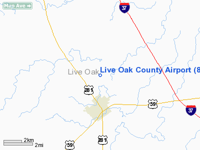
Location & QuickFacts
| FAA Information Effective: | 2008-09-25 |
| Airport Identifier: | 8T6 |
| Airport Status: | Operational |
| Longitude/Latitude: | 098-06-59.2866W/28-21-46.0945N
-98.116468/28.362804 (Estimated) |
| Elevation: | 129 ft / 39.32 m (Surveyed) |
| Land: | 100 acres |
| From nearest city: | 2 nautical miles N of George West, TX |
| Location: | Live Oak County, TX |
| Magnetic Variation: | 07E (1985) |
Owner & Manager
| Ownership: | Publicly owned |
| Owner: | Live Oak County |
| Address: | County Courthouse
George West, TX 78022 |
| Phone number: | 361-449-2733 |
| Manager: | Jim Huff,co Judge |
| Address: | Po Box 487
George West, TX 78022 |
| Phone number: | 361-449-2733
EXT 101. |
Airport Operations and Facilities
| Airport Use: | Open to public |
| Wind indicator: | Yes |
| Segmented Circle: | Yes |
| Control Tower: | No |
| Lighting Schedule: | DUSK-DAWN
MIRL RY 13/31 PRESET LOW INTST; TO INCR INTST ACTVT - 122.7. |
| Beacon Color: | Clear-Green (lighted land airport) |
| Sectional chart: | San Antonio |
| Region: | ASW - Southwest |
| Boundary ARTCC: | ZHU - Houston |
| Tie-in FSS: | SJT - San Angelo |
| FSS Toll Free: | 1-800-WX-BRIEF |
| NOTAMs Facility: | SJT (NOTAM-d service avaliable) |
Airport Communications
Airport Services
| Fuel available: | 100LLA
FUEL SELF-SERVE WITH MAJOR CREDIT CARD. |
Runway Information
Runway 13/31
| Dimension: | 3800 x 60 ft / 1158.2 x 18.3 m |
| Surface: | ASPH, Fair Condition |
| Edge Lights: | Medium |
| |
Runway 13 |
Runway 31 |
| Longitude: | 098-07-14.1147W | 098-06-44.4595W |
| Latitude: | 28-21-59.5781N | 28-21-32.6105N |
| Elevation: | 128.00 ft | 126.00 ft |
| Alignment: | 127 | 127 |
| Traffic Pattern: | Left | Left |
| Markings: | Basic, Good Condition | Basic, Good Condition |
| Obstruction: | 45 ft pline, 1170.0 ft from runway, 222 ft right of centerline, 21:1 slope to clear | , 50:1 slope to clear |
|
Radio Navigation Aids
| ID |
Type |
Name |
Ch |
Freq |
Var |
Dist |
| BEA | NDB | Beeville | | 284.00 | 07E | 17.0 nm |
| PEZ | NDB | Pleasanton | | 275.00 | 07E | 41.4 nm |
| TKB | NDB | Kleberg County | | 347.00 | 06E | 45.5 nm |
| MNO | NDB | Mellon Ranch | | 375.00 | 06E | 48.4 nm |
| NOG | TACAN | Orange Grove | 063X | | 09E | 28.4 nm |
| ALI | VOR | Alice | | 114.50 | 06E | 37.8 nm |
| THX | VORTAC | Three Rivers | 051X | 111.40 | 08E | 8.7 nm |
| CRP | VORTAC | Corpus Christi | 102X | 115.50 | 09E | 45.0 nm |
Remarks
- DEER ON & INVOF RY (SEASONAL).
- BIRDS ON & INVOF ARPT.
- PRVDD EXISTING LIVE OAK COUNTY APT CLOSES PRIOR TO COMMENCEMENT OF FLIGHT OPNS AT NEW SITE.
Images and information placed above are from
http://www.airport-data.com/airport/8T6/
We thank them for the data!
| General Info
|
| Country |
United States
|
| State |
TEXAS
|
| FAA ID |
8T6
|
| Latitude |
28-21-45.995N
|
| Longitude |
098-06-59.019W
|
| Elevation |
129 feet
|
| Near City |
GEORGE WEST
|
We don't guarantee the information is fresh and accurate. The data may
be wrong or outdated.
For more up-to-date information please refer to other sources.
|
|


