 |
|
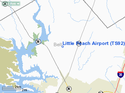
Location & QuickFacts
| FAA Information Effective: | 2008-09-25 |
| Airport Identifier: | TS92 |
| Airport Status: | Operational |
| Longitude/Latitude: | 097-25-36.0350W/31-12-52.6270N
-97.426676/31.214619 (Estimated) |
| Elevation: | 710 ft / 216.41 m (Estimated) |
| Land: | 0 acres |
| From nearest city: | 12 nautical miles NW of Temple, TX |
| Location: | Bell County, TX |
| Magnetic Variation: | 07E (1985) |
Owner & Manager
| Ownership: | Privately owned |
| Owner: | William C Elliot |
| Address: | Rt 5/box 342a
Temple, TX 76501 |
| Phone number: | 817-986-2673 |
| Address: |
|
Airport Operations and Facilities
| Airport Use: | Private |
| Wind indicator: | Yes |
| Segmented Circle: | No |
| Control Tower: | No |
| Sectional chart: | San Antonio |
| Region: | ASW - Southwest |
| Boundary ARTCC: | ZFW - Fort Worth |
| Tie-in FSS: | FTW - Fort Worth |
| FSS Phone: | 817-541-3474 |
| FSS Toll Free: | 1-800-WX-BRIEF |
Runway Information
Runway 15/33
| Dimension: | 1600 x 50 ft / 487.7 x 15.2 m |
| Surface: | TURF, |
| |
Runway 15 |
Runway 33 |
| Traffic Pattern: | Left | Left |
|
Radio Navigation Aids
| ID |
Type |
Name |
Ch |
Freq |
Var |
Dist |
| HLR | NDB | Hood | | 347.00 | 07E | 15.5 nm |
| IL | NDB | Iresh | | 278.00 | 07E | 18.5 nm |
| GR | NDB | Starn | | 323.00 | 07E | 23.4 nm |
| ROB | NDB | Robinson | | 400.00 | 07E | 25.3 nm |
| GUO | NDB | Georgetown | | 332.00 | 06E | 34.4 nm |
| MNZ | NDB | Hamilton | | 251.00 | 07E | 44.3 nm |
| TPL | VOR/DME | Temple | 041X | 110.40 | 09E | 0.3 nm |
| GRK | VOR/DME | Gray | 055X | 111.80 | 07E | 22.7 nm |
| ACT | VORTAC | Waco | 100X | 115.30 | 09E | 28.1 nm |
| LZZ | VORTAC | Lampasas | 072X | 112.50 | 08E | 36.8 nm |
Remarks
- PRVDD AN OPERATING AGREEMENT IS ESTABLISHED WITH DRAUGHON-MILLER MUNI ARPT.
Images and information placed above are from
http://www.airport-data.com/airport/TS92/
We thank them for the data!
| General Info
|
| Country |
United States
|
| State |
TEXAS
|
| FAA ID |
TS92
|
| Latitude |
31-12-52.627N
|
| Longitude |
097-25-36.035W
|
| Elevation |
710 feet
|
| Near City |
TEMPLE
|
We don't guarantee the information is fresh and accurate. The data may
be wrong or outdated.
For more up-to-date information please refer to other sources.
|
|


