 |
|
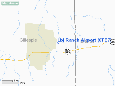
Location & QuickFacts
| FAA Information Effective: | 2008-09-25 |
| Airport Identifier: | 0TE7 |
| Airport Status: | Operational |
| Longitude/Latitude: | 098-37-21.1120W/30-15-06.5260N
-98.622531/30.251813 (Estimated) |
| Elevation: | 1515 ft / 461.77 m (Surveyed) |
| Land: | 35 acres |
| From nearest city: | 13 nautical miles W of Johnson City, TX |
| Location: | Gillespie County, TX |
| Magnetic Variation: | 08E (1980) |
Owner & Manager
| Ownership: | Privately owned |
| Owner: | Us Dept Of Interior, Natl Park Svc |
| Address: | Po Box 329
Johnson City, TX 78636 |
| Phone number: | 830-868-7128 |
| Manager: | Superintendent Lbj Natl Hist Park |
| Address: | Po Box 329
Johnson City, TX 78636 |
| Phone number: | 830-868-7128 |
Airport Operations and Facilities
| Airport Use: | Private |
| Wind indicator: | Yes |
| Segmented Circle: | No |
| Control Tower: | No |
| Landing fee charge: | No |
| Sectional chart: | San Antonio |
| Region: | ASW - Southwest |
| Boundary ARTCC: | ZHU - Houston |
| Tie-in FSS: | SJT - San Angelo |
| FSS on Airport: | No |
| FSS Toll Free: | 1-800-WX-BRIEF |
| NOTAMs Facility: | (NOTAM-d service avaliable) |
Airport Communications
Airport Services
| Airframe Repair: | NONE |
| Power Plant Repair: | NONE |
Runway Information
Runway 17/35
| Dimension: | 6291 x 60 ft / 1917.5 x 18.3 m |
| Surface: | ASPH, |
| |
Runway 17 |
Runway 35 |
| Longitude: | 098-37-24.1470W | 098-37-18.1300W |
| Latitude: | 30-15-37.5770N | 30-14-35.5220N |
| Elevation: | 1515.00 ft | 1433.00 ft |
| Alignment: | 127 | 127 |
| Traffic Pattern: | Left | Left |
|
Radio Navigation Aids
| ID |
Type |
Name |
Ch |
Freq |
Var |
Dist |
| MFS | NDB | Horseshoe Bay Resort | | 403.00 | 07E | 21.3 nm |
| ER | NDB | Shein | | 263.00 | 08E | 28.5 nm |
| BMQ | NDB | Burnet | | 341.00 | 07E | 35.5 nm |
| DHK | TACAN | Randolph | 036X | | 09E | 46.8 nm |
| STV | VORTAC | Stonewall | 085X | 113.80 | 08E | 5.1 nm |
| LLO | VORTAC | Llano | 019X | 108.20 | 08E | 33.8 nm |
| CSI | VORTAC | Center Point | 122X | 117.50 | 08E | 36.6 nm |
| SAT | VORTAC | San Antonio | 115X | 116.80 | 08E | 37.5 nm |
| RND | VORTAC | Randolph | 70X | 112.30 | 09E | 47.4 nm |
| SAT | VOT | San Antonio Intl | | 110.40 | | 43.9 nm |
Remarks
- APRON COND FAIR WITH SOME ASPH DETERIORATION.
- EXTSV VEHICULAR TFC ON RWY. PPR BEFORE LNDG. 122.8/257.8 MONTRD 24 H4S. NO TWR.
- OWNER DESIRES ARPT NOT BE CHARTED.
Images and information placed above are from
http://www.airport-data.com/airport/0TE7/
We thank them for the data!
| General Info
|
| Country |
United States
|
| State |
TEXAS
|
| FAA ID |
0TE7
|
| Latitude |
30-15-06.526N
|
| Longitude |
098-37-21.112W
|
| Elevation |
1515 feet
|
| Near City |
JOHNSON CITY
|
We don't guarantee the information is fresh and accurate. The data may
be wrong or outdated.
For more up-to-date information please refer to other sources.
|
|


