 |
|
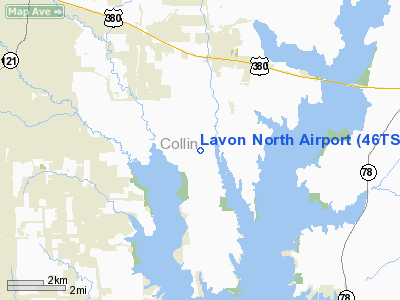
Location & QuickFacts
| FAA Information Effective: | 2008-09-25 |
| Airport Identifier: | 46TS |
| Airport Status: | Operational |
| Longitude/Latitude: | 096-30-34.9550W/33-07-41.4220N
-96.509710/33.128173 (Estimated) |
| Elevation: | 565 ft / 172.21 m (Estimated) |
| Land: | 78 acres |
| From nearest city: | 26 nautical miles NE of Dallas, TX |
| Location: | Collin County, TX |
| Magnetic Variation: | 06E (1985) |
Owner & Manager
| Ownership: | Privately owned |
| Owner: | Lavon North Inc |
| Address: | Po Box 810395
Dallas, TX 75381-0395 |
| Phone number: | 214-241-8132 |
| Manager: | Furure Flight Inc |
| Address: | Box 100 County Rd 392
Mc Kinney, TX 75068 |
| Phone number: | 214-736-6000 |
Airport Operations and Facilities
| Airport Use: | Private |
| Wind indicator: | Yes |
| Segmented Circle: | Yes |
| Control Tower: | No |
| Landing fee charge: | No |
| Sectional chart: | Dallas-ft Worth |
| Region: | ASW - Southwest |
| Boundary ARTCC: | ZFW - Fort Worth |
| Tie-in FSS: | FTW - Fort Worth |
| FSS on Airport: | No |
| FSS Phone: | 817-541-3474 |
| FSS Toll Free: | 1-800-WX-BRIEF |
Airport Communications
Airport Services
| Bottled Oxygen: | NONE |
| Bulk Oxygen: | NONE |
Runway Information
Runway 13/31
| Dimension: | 2570 x 35 ft / 783.3 x 10.7 m |
| Surface: | TURF, Fair Condition |
| |
Runway 13 |
Runway 31 |
| Traffic Pattern: | Left | Left |
| Obstruction: | 30 ft pline, 100 ft left of centerline | 20 ft tree, 0.0 ft from runway, 50 ft left of centerline |
|
Runway 17/35
| Dimension: | 1900 x 20 ft / 579.1 x 6.1 m |
| Surface: | GRVL, Fair Condition |
| |
Runway 17 |
Runway 35 |
| Traffic Pattern: | Left | Left |
| Obstruction: | 30 ft pline, 85.0 ft from runway, 2:1 slope to clear | 5 ft bush, 40.0 ft from runway, 40 ft left of centerline, 8:1 slope to clear |
|
Radio Navigation Aids
| ID |
Type |
Name |
Ch |
Freq |
Var |
Dist |
| MII | NDB | Caddo Mills | | 316.00 | 06E | 14.2 nm |
| PQF | NDB | Mesquite | | 248.00 | 06E | 19.2 nm |
| SYW | NDB | Cash | | 428.00 | 05E | 24.0 nm |
| AVZ | NDB | Travis | | 260.00 | 06E | 25.7 nm |
| JUG | NDB | Jecca | | 388.00 | 06E | 27.7 nm |
| RBD | NDB | Redbird | | 287.00 | 06E | 32.7 nm |
| HJM | NDB | Rayburn | | 415.00 | 06E | 33.7 nm |
| LNC | NDB | Lancaster | | 239.00 | 06E | 34.8 nm |
| XQH | NDB | Cedar Hill | | 353.00 | 08E | 40.0 nm |
| DNI | NDB | Denison | | 341.00 | 06E | 42.6 nm |
| DUA | NDB | Durant | | 359.00 | 05E | 49.2 nm |
| GLE | NDB | Gainesville | | 330.00 | 06E | 49.5 nm |
| MJF | TACAN | Arvilla | 033X | | 05E | 22.9 nm |
| CVE | VOR/DME | Cowboy | 109X | 116.20 | 06E | 24.5 nm |
| TTT | VOR/DME | Maverick | 078X | 113.10 | 06E | 31.0 nm |
| SLR | VOR/DME | Sulphur Springs | 027X | 109.00 | 08E | 48.8 nm |
| URH | VOR/DME | Texoma | 090X | 114.30 | 05E | 49.4 nm |
| BYP | VORTAC | Bonham | 093X | 114.60 | 06E | 28.2 nm |
| FUZ | VORTAC | Ranger | 104X | 115.70 | 06E | 36.7 nm |
| DAL | VOT | Dallas Love Field | | 113.30 | | 24.1 nm |
| FTW | VOT | Fort Worth Meacham | | 108.20 | | 46.7 nm |
Remarks
- TALL GRASS AT INTERSECTION OF RWY 17/35 & 13/31 AND SE OF RWY 17.
Images and information placed above are from
http://www.airport-data.com/airport/46TS/
We thank them for the data!
| General Info
|
| Country |
United States
|
| State |
TEXAS
|
| FAA ID |
46TS
|
| Latitude |
33-07-41.422N
|
| Longitude |
096-30-34.955W
|
| Elevation |
565 feet
|
| Near City |
DALLAS
|
We don't guarantee the information is fresh and accurate. The data may
be wrong or outdated.
For more up-to-date information please refer to other sources.
|
|


