 |
|
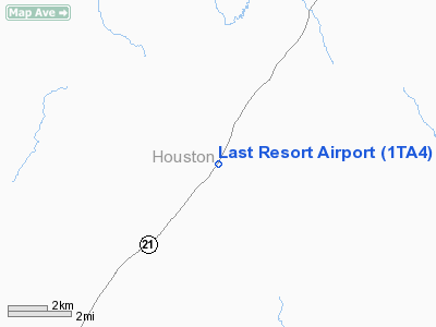
Location & QuickFacts
| FAA Information Effective: | 2008-09-25 |
| Airport Identifier: | 1TA4 |
| Airport Status: | Operational |
| Longitude/Latitude: | 095-17-45.7940W/31-27-30.6470N
-95.296054/31.458513 (Estimated) |
| Elevation: | 420 ft / 128.02 m (Estimated) |
| Land: | 0 acres |
| From nearest city: | 10 nautical miles NE of Crockett, TX |
| Location: | Houston County, TX |
| Magnetic Variation: | 06E (1985) |
Owner & Manager
| Ownership: | Privately owned |
| Owner: | John M Hammons |
| Address: | Rt 2, Box 179
Grapeland, TX 75844 |
| Phone number: | 409-544-2406 |
| Manager: | John M Hammons |
| Address: | Rt 2, Box 179
Grapeland, TX 75844 |
| Phone number: | 409-544-2406 |
Airport Operations and Facilities
| Airport Use: | Private |
| Wind indicator: | Yes |
| Segmented Circle: | No |
| Control Tower: | No |
| Landing fee charge: | No |
| Sectional chart: | Houston |
| Region: | ASW - Southwest |
| Boundary ARTCC: | ZHU - Houston |
| Tie-in FSS: | CXO - Montgomery County |
| FSS on Airport: | No |
| FSS Toll Free: | 1-800-WX-BRIEF
FOR FP FILING CALL CXO FSS 1-800-833-5602. |
Runway Information
Runway 15/33
| Dimension: | 2300 x 50 ft / 701.0 x 15.2 m |
| Surface: | TURF, |
| |
Runway 15 |
Runway 33 |
| Traffic Pattern: | Left | Left |
| Obstruction: | 40 ft pline, 800.0 ft from runway | 50 ft trees, 500.0 ft from runway |
|
Radio Navigation Aids
| ID |
Type |
Name |
Ch |
Freq |
Var |
Dist |
| JSO | NDB | Cherokee County | | 263.00 | 05E | 25.1 nm |
| PSN | NDB | Palestine | | 375.00 | 04E | 28.3 nm |
| OC | NDB | Nados | | 253.00 | 05E | 29.6 nm |
| GXD | NDB | Nacogdoches | | 391.00 | 05E | 32.3 nm |
| UTS | NDB | Huntsville | | 308.00 | 06E | 45.7 nm |
| LIQ | NDB | Lochridge Ranch | | 335.00 | 09E | 47.2 nm |
| HNO | NDB | Henderson | | 371.00 | 06E | 49.2 nm |
| CSZ | NDB | Crossroads | | 215.00 | 08E | 49.7 nm |
| FZT | VOR/DME | Frankston | 051X | 111.40 | 06E | 38.9 nm |
| LFK | VORTAC | Lufkin | 058X | 112.10 | 05E | 34.7 nm |
| LOA | VORTAC | Leona | 045X | 110.80 | 08E | 39.9 nm |
Remarks
- VFR OPNS PRVDD APCH SLOPES TO LANDING AREA ARE MAINTD IAW PART 77 OF FAR.
Images and information placed above are from
http://www.airport-data.com/airport/1TA4/
We thank them for the data!
| General Info
|
| Country |
United States
|
| State |
TEXAS
|
| FAA ID |
1TA4
|
| Latitude |
31-27-30.647N
|
| Longitude |
095-17-45.794W
|
| Elevation |
420 feet
|
| Near City |
CROCKETT
|
We don't guarantee the information is fresh and accurate. The data may
be wrong or outdated.
For more up-to-date information please refer to other sources.
|
|


