 |
|
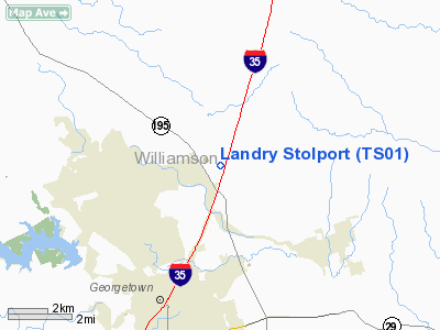
Location & QuickFacts
| FAA Information Effective: | 2008-09-25 |
| Airport Identifier: | TS01 |
| Airport Status: | Operational |
| Longitude/Latitude: | 097-39-01.0330W/30-42-45.6870N
-97.650287/30.712691 (Estimated) |
| Elevation: | 780 ft / 237.74 m (Estimated) |
| Land: | 7 acres |
| From nearest city: | 4 nautical miles N of Geogetown, TX |
| Location: | Williamson County, TX |
| Magnetic Variation: | 07E (1985) |
Owner & Manager
| Ownership: | Privately owned |
| Owner: | Howard Landry |
| Address: | Box 222
Georgetown, TX 78627 |
| Phone number: | 512-863-3773 |
| Manager: | Howard Landry |
| Address: | Box 222
Georgetown, TX 78627 |
| Phone number: | 512-863-3773 |
Airport Operations and Facilities
| Airport Use: | Private |
| Segmented Circle: | No |
| Control Tower: | No |
| Lighting Schedule: | NONE |
| Sectional chart: | San Antonio |
| Region: | ASW - Southwest |
| Boundary ARTCC: | ZHU - Houston |
| Tie-in FSS: | SJT - San Angelo |
| FSS Toll Free: | 1-800-WX-BRIEF |
Runway Information
Runway 18/36
| Dimension: | 1400 x 30 ft / 426.7 x 9.1 m |
| Surface: | GRVL, |
| |
Runway 18 |
Runway 36 |
| Traffic Pattern: | Right | Left |
| Obstruction: | 25 ft bldg, 10.0 ft from runway | 30 ft pline, 300.0 ft from runway |
|
Radio Navigation Aids
| ID |
Type |
Name |
Ch |
Freq |
Var |
Dist |
| GUO | NDB | Georgetown | | 332.00 | 06E | 2.3 nm |
| IL | NDB | Iresh | | 278.00 | 07E | 19.0 nm |
| HLR | NDB | Hood | | 347.00 | 07E | 25.2 nm |
| GR | NDB | Starn | | 323.00 | 07E | 29.8 nm |
| BMQ | NDB | Burnet | | 341.00 | 07E | 30.3 nm |
| MFS | NDB | Horseshoe Bay Resort | | 403.00 | 07E | 38.3 nm |
| GYB | NDB | Lee County | | 385.00 | 07E | 47.7 nm |
| GRK | VOR/DME | Gray | 055X | 111.80 | 07E | 21.0 nm |
| TPL | VOR/DME | Temple | 041X | 110.40 | 09E | 32.0 nm |
| CWK | VORTAC | Centex | 075X | 112.80 | 06E | 21.0 nm |
| LZZ | VORTAC | Lampasas | 072X | 112.50 | 08E | 38.1 nm |
Remarks
- ELECTRIC WIRES ON EAST & WEST SIDE OF RWY 18/36.
- PRVDD THRS ARE LCTD TO PRVD A 20:1 CLEARANCE OVER ANY OBJECTS IN THE APCH AREAS.
Images and information placed above are from
http://www.airport-data.com/airport/TS01/
We thank them for the data!
| General Info
|
| Country |
United States
|
| State |
TEXAS
|
| FAA ID |
TS01
|
| Latitude |
30-42-45.687N
|
| Longitude |
097-39-01.033W
|
| Elevation |
780 feet
|
| Near City |
GEOGETOWN
|
We don't guarantee the information is fresh and accurate. The data may
be wrong or outdated.
For more up-to-date information please refer to other sources.
|
|


