 |
|
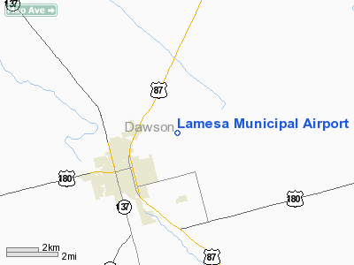
Location & QuickFacts
| FAA Information Effective: | 2008-09-25 |
| Airport Identifier: | 2F5 |
| Airport Status: | Operational |
| Longitude/Latitude: | 101-55-12.8278W/32-45-22.6668N
-101.920230/32.756296 (Estimated) |
| Elevation: | 2999 ft / 914.10 m (Surveyed) |
| Land: | 91 acres |
| From nearest city: | 2 nautical miles NE of Lamesa, TX |
| Location: | Dawson County, TX |
| Magnetic Variation: | 09E (1995) |
Owner & Manager
| Ownership: | Publicly owned |
| Owner: | Lamesa City & Dawson Co |
| Address: | 601 S. 1st
Lamesa, TX 79331 |
| Phone number: | 806-872-2124 |
| Manager: | Fred Vera
CITY MANAGER |
| Address: | 601 S. 1st
Lamesa, TX 79331 |
| Phone number: | 806-872-2124 |
Airport Operations and Facilities
| Airport Use: | Open to public |
| Wind indicator: | Yes |
| Segmented Circle: | Yes |
| Control Tower: | No |
| Lighting Schedule: | DUSK-DAWN
ACTVT MIRL RY 07/25 - CTAF. MIRL RY 16/34 OPER DUSK-2330; AFT 2330 ACTVT - CTAF. |
| Beacon Color: | Clear-Green (lighted land airport) |
| Landing fee charge: | No |
| Sectional chart: | Dallas-ft Worth |
| Region: | ASW - Southwest |
| Boundary ARTCC: | ZFW - Fort Worth |
| Tie-in FSS: | FTW - Fort Worth |
| FSS on Airport: | No |
| FSS Phone: | 817-541-3474 |
| FSS Toll Free: | 1-800-WX-BRIEF |
| NOTAMs Facility: | FTW (NOTAM-d service avaliable) |
| Federal Agreements: | NGY |
Airport Communications
| CTAF: | 122.800 |
| Unicom: | 122.800 |
Airport Services
| Fuel available: | 100LL |
| Airframe Repair: | MINOR |
| Power Plant Repair: | MAJOR |
Runway Information
Runway 07/25
| Dimension: | 4000 x 50 ft / 1219.2 x 15.2 m |
| Surface: | ASPH, Good Condition |
| Weight Limit: | Single wheel: 12000 lbs. |
| Edge Lights: | Medium |
| |
Runway 07 |
Runway 25 |
| Longitude: | 101-55-53.4827W | 101-55-08.1408W |
| Latitude: | 32-45-28.7849N | 32-45-38.7046N |
| Elevation: | 2992.00 ft | 2991.00 ft |
| Alignment: | 75 | 127 |
| Traffic Pattern: | Left | Left |
| Markings: | Basic, Good Condition | Basic, Good Condition |
| Obstruction: | , 50:1 slope to clear | 15 ft road, 721.0 ft from runway, 34:1 slope to clear |
|
Runway 16/34
| Dimension: | 5000 x 75 ft / 1524.0 x 22.9 m |
| Surface: | ASPH, Good Condition |
| Weight Limit: | Single wheel: 20000 lbs. |
| Edge Lights: | Medium |
| |
Runway 16 |
Runway 34 |
| Longitude: | 101-55-05.8470W | 101-54-51.0342W |
| Latitude: | 32-45-37.7331N | 32-44-49.8745N |
| Elevation: | 2992.00 ft | 2985.00 ft |
| Alignment: | 127 | 127 |
| Traffic Pattern: | Left | Left |
| Markings: | Non-precision instrument, Good Condition | Non-precision instrument, Good Condition |
| Crossing Height: | 31.00 ft | 31.00 ft |
| VASI: | 2-light PAPI on left side | 2-light PAPI on left side |
| Visual Glide Angle: | 3.00° | 3.00° |
| Obstruction: | 12 ft road, 530.0 ft from runway, 27:1 slope to clear | , 50:1 slope to clear |
|
Radio Navigation Aids
| ID |
Type |
Name |
Ch |
Freq |
Var |
Dist |
| LSA | NDB | Lamesa | | 338.00 | 09E | 0.2 nm |
| BFE | NDB | Brownfield | | 311.00 | 09E | 28.9 nm |
| GNC | NDB | Gaines County | | 344.00 | 09E | 37.0 nm |
| ANR | NDB | Andrews | | 245.00 | 09E | 39.7 nm |
| SDR | NDB | Snyder | | 359.00 | 08E | 49.4 nm |
| BGS | VORTAC | Big Spring | 090X | 114.30 | 11E | 31.4 nm |
| MAF | VORTAC | Midland | 095X | 114.80 | 11E | 46.9 nm |
Images and information placed above are from
http://www.airport-data.com/airport/2F5/
We thank them for the data!
| General Info
|
| Country |
United States
|
| State |
TEXAS
|
| FAA ID |
2F5
|
| Latitude |
32-45-22.600N
|
| Longitude |
101-55-10.100W
|
| Elevation |
2998 feet
|
| Near City |
LAMESA
|
We don't guarantee the information is fresh and accurate. The data may
be wrong or outdated.
For more up-to-date information please refer to other sources.
|
|


