 |
|
Location & QuickFacts
| FAA Information Effective: | 2008-09-25 |
| Airport Identifier: | 0XS6 |
| Airport Status: | Operational |
| Longitude/Latitude: | 098-08-49.0650W/30-30-03.6970N
-98.146963/30.501027 (Estimated) |
| Elevation: | 800 ft / 243.84 m (Estimated) |
| Land: | 0 acres |
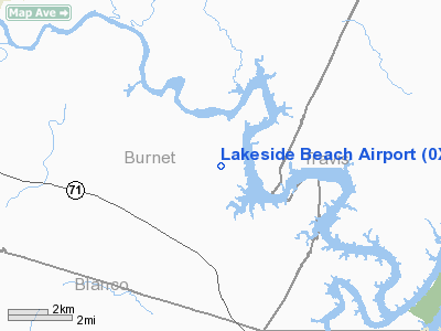
| From nearest city: | 2 nautical miles NE of Spicewood, TX |
| Location: | Burnet County, TX |
| Magnetic Variation: | 07E (1985) |
Owner & Manager
| Ownership: | Privately owned |
| Owner: | Lakeside Beach Civic Assoc. |
| Address: | Route 2, Box 336-d
Spicewood, TX 78669 |
| Phone number: | 512-693-2598 |
| Manager: | Ray Rylander |
| Address: | P.o. Box 393
Spicewood, TX 78669-0393 |
| Phone number: | 830-693-1022 |
Airport Operations and Facilities
| Airport Use: | Private |
| Segmented Circle: | No |
| Control Tower: | No |
| Sectional chart: | San Antonio |
| Region: | ASW - Southwest |
| Boundary ARTCC: | ZHU - Houston |
| Tie-in FSS: | SJT - San Angelo |
| FSS on Airport: | No |
| FSS Toll Free: | 1-800-WX-BRIEF |
Airport Services
Runway Information
Runway 17/35
| Dimension: | 3000 x 75 ft / 914.4 x 22.9 m |
| Surface: | TURF, |
| |
Runway 17 |
Runway 35 |
| Traffic Pattern: | Left | Left |
|
Radio Navigation Aids
| ID |
Type |
Name |
Ch |
Freq |
Var |
Dist |
| MFS | NDB | Horseshoe Bay Resort | | 403.00 | 07E | 11.0 nm |
| BMQ | NDB | Burnet | | 341.00 | 07E | 15.1 nm |
| GUO | NDB | Georgetown | | 332.00 | 06E | 26.6 nm |
| IL | NDB | Iresh | | 278.00 | 07E | 38.8 nm |
| GR | NDB | Starn | | 323.00 | 07E | 42.4 nm |
| HLR | NDB | Hood | | 347.00 | 07E | 43.9 nm |
| GRK | VOR/DME | Gray | 055X | 111.80 | 07E | 36.3 nm |
| CWK | VORTAC | Centex | 075X | 112.80 | 06E | 32.8 nm |
| STV | VORTAC | Stonewall | 085X | 113.80 | 08E | 34.0 nm |
| LLO | VORTAC | Llano | 019X | 108.20 | 08E | 37.6 nm |
| LZZ | VORTAC | Lampasas | 072X | 112.50 | 08E | 41.1 nm |
Images and information placed above are from
http://www.airport-data.com/airport/0XS6/
We thank them for the data!
| General Info
|
| Country |
United States
|
| State |
TEXAS
|
| FAA ID |
0XS6
|
| Latitude |
30-30-03.697N
|
| Longitude |
098-08-49.065W
|
| Elevation |
800 feet
|
| Near City |
SPICEWOOD
|
We don't guarantee the information is fresh and accurate. The data may
be wrong or outdated.
For more up-to-date information please refer to other sources.
|
|


