 |
|
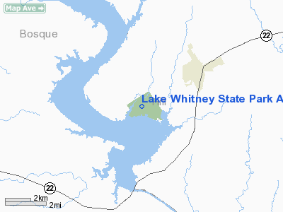
Lake Whitney State Park Airport |
Location & QuickFacts
| FAA Information Effective: | 2008-09-25 |
| Airport Identifier: | F50 |
| Airport Status: | Operational |
| Longitude/Latitude: | 097-21-53.0480W/31-55-30.5630N
-97.364736/31.925156 (Estimated) |
| Elevation: | 564 ft / 171.91 m (Estimated) |
| Land: | 90 acres |
| From nearest city: | 3 nautical miles SW of Whitney, TX |
| Location: | Hill County, TX |
| Magnetic Variation: | 07E (1985) |
Owner & Manager
| Ownership: | Publicly owned |
| Owner: | Lake Whitney State Park |
| Address: | Po Box 1175
Whitney, TX 76692 |
| Phone number: | 254-694-3793 |
| Manager: | Jeffrey Towers, Park Supt |
| Address: | Po Box 1175
Whitney, TX 76692 |
| Phone number: | 254-694-3793 |
Airport Operations and Facilities
| Airport Use: | Open to public |
| Wind indicator: | Yes |
| Segmented Circle: | Yes
SEGMENTED CIRCLE NSTD, ONLY HALF CIRCLE PRESENT DUE TO PROXIMITY OF RUNWAY. |
| Control Tower: | No |
| Sectional chart: | San Antonio |
| Region: | ASW - Southwest |
| Boundary ARTCC: | ZFW - Fort Worth |
| Tie-in FSS: | FTW - Fort Worth |
| FSS on Airport: | No |
| FSS Phone: | 817-541-3474 |
| FSS Toll Free: | 1-800-WX-BRIEF |
| NOTAMs Facility: | FTW (NOTAM-d service avaliable) |
Airport Communications
Airport Services
| Airframe Repair: | NONE |
| Power Plant Repair: | NONE |
| Bottled Oxygen: | NONE |
| Bulk Oxygen: | NONE |
Runway Information
Runway 17/35
| Dimension: | 2000 x 50 ft / 609.6 x 15.2 m |
| Surface: | ASPH, Fair Condition |
| Weight Limit: | Single wheel: 10000 lbs. |
| |
Runway 17 |
Runway 35 |
| Traffic Pattern: | Left | Left |
| Markings: | Basic, Good Condition | Basic, Good Condition |
| Obstruction: | 30 ft tree, 640.0 ft from runway, 90 ft left of centerline, 14:1 slope to clear | 40 ft tree, 545.0 ft from runway, 130 ft left of centerline, 8:1 slope to clear |
|
Radio Navigation Aids
| ID |
Type |
Name |
Ch |
Freq |
Var |
Dist |
| ROB | NDB | Robinson | | 400.00 | 07E | 29.5 nm |
| MNZ | NDB | Hamilton | | 251.00 | 07E | 44.0 nm |
| XQH | NDB | Cedar Hill | | 353.00 | 08E | 44.6 nm |
| LXY | NDB | Mexia | | 329.00 | 07E | 46.8 nm |
| CGQ | NDB | Powell | | 344.00 | 06E | 48.5 nm |
| CRS | NDB | Corsicana | | 396.00 | 06E | 49.8 nm |
| TPL | VOR/DME | Temple | 041X | 110.40 | 09E | 43.1 nm |
| GNL | VOR/DME | Groesbeck | 025X | 108.80 | 05E | 46.5 nm |
| ACT | VORTAC | Waco | 100X | 115.30 | 09E | 16.5 nm |
| JEN | VORTAC | Glen Rose | 097X | 115.00 | 06E | 29.7 nm |
Remarks
- DEER ON & INVOF ARPT.
- TURN-A-ROUND ON RWY 35 OFTEN USED FOR ACFT PARKING.
Images and information placed above are from
http://www.airport-data.com/airport/F50/
We thank them for the data!
| General Info
|
| Country |
United States
|
| State |
TEXAS
|
| FAA ID |
F50
|
| Latitude |
31-55-30.563N
|
| Longitude |
097-21-53.048W
|
| Elevation |
564 feet
|
| Near City |
WHITNEY
|
We don't guarantee the information is fresh and accurate. The data may
be wrong or outdated.
For more up-to-date information please refer to other sources.
|
|


