 |
|
Location & QuickFacts
| FAA Information Effective: | 2008-09-25 |
| Airport Identifier: | 33TA |
| Airport Status: | Operational |
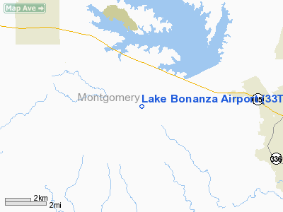
| Longitude/Latitude: | 095-36-43.7990W/30-19-58.7500N
-95.612166/30.332986 (Estimated) |
| Elevation: | 301 ft / 91.74 m (Estimated) |
| Land: | 0 acres |
| From nearest city: | 6 nautical miles SE of Montgomery, TX |
| Location: | Montgomery County, TX |
| Magnetic Variation: | 06E (1985) |
Owner & Manager
| Ownership: | Privately owned |
| Owner: | Lake Bonanza Property Owners |
| Address: | P O Box 383
Montgomery, TX 77356 |
| Manager: | Johnnie Smith |
| Address: | 5898 Skylane Dr
Montgomery, TX 77316 |
| Phone number: | 936-447-3665 |
Airport Operations and Facilities
| Airport Use: | Private |
| Wind indicator: | Yes |
| Segmented Circle: | No |
| Control Tower: | No |
| Landing fee charge: | No |
| Sectional chart: | Houston |
| Region: | ASW - Southwest |
| Boundary ARTCC: | ZHU - Houston |
| Tie-in FSS: | CXO - Montgomery County |
| FSS on Airport: | No |
| FSS Toll Free: | 1-800-WX-BRIEF |
Runway Information
Runway 17/35
| Dimension: | 2579 x 200 ft / 786.1 x 61.0 m |
| Surface: | TURF, |
| |
Runway 17 |
Runway 35 |
| Traffic Pattern: | Left | Left |
| Obstruction: | 60 ft trees, 5.0 ft from runway | |
|
Radio Navigation Aids
| ID |
Type |
Name |
Ch |
Freq |
Var |
Dist |
| DWH | NDB | David Hooks | | 521.00 | 05E | 12.7 nm |
| EYQ | NDB | Weiser | | 286.00 | 06E | 24.0 nm |
| UTS | NDB | Huntsville | | 308.00 | 06E | 24.5 nm |
| BVP | NDB | Nixin | | 326.00 | 05E | 29.0 nm |
| LYD | NDB | Lakeside | | 249.00 | 05E | 31.2 nm |
| BNH | NDB | Brenham | | 362.00 | 06E | 40.1 nm |
| SGR | NDB | Hull | | 388.00 | 05E | 42.2 nm |
| JPA | NDB | Sanjac | | 347.00 | 05E | 48.9 nm |
| EFD | TACAN | Ellington | 031X | | 05E | 49.6 nm |
| HUB | VOR/DME | Hobby | 118X | 117.10 | 05E | 44.3 nm |
| TNV | VORTAC | Navasota | 106X | 115.90 | 08E | 23.3 nm |
| IAH | VORTAC | Humble | 113X | 116.60 | 05E | 26.5 nm |
| CLL | VORTAC | College Station | 080X | 113.30 | 08E | 45.0 nm |
| HOU | VOT | Houston Wm P Hobby | | 108.40 | | 44.8 nm |
Images and information placed above are from
http://www.airport-data.com/airport/33TA/
We thank them for the data!
| General Info
|
| Country |
United States
|
| State |
TEXAS
|
| FAA ID |
33TA
|
| Latitude |
30-19-58.750N
|
| Longitude |
095-36-43.799W
|
| Elevation |
301 feet
|
| Near City |
MONTGOMERY
|
We don't guarantee the information is fresh and accurate. The data may
be wrong or outdated.
For more up-to-date information please refer to other sources.
|
|


