 |
|
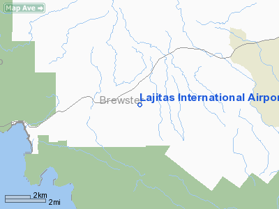
Location & QuickFacts
| FAA Information Effective: | 2008-09-25 |
| Airport Identifier: | 89TE |
| Airport Status: | Operational |
| Longitude/Latitude: | 103-41-14.1300W/29-16-40.6400N
-103.687258/29.277956 (Estimated) |
| Elevation: | 2630 ft / 801.62 m (Surveyed) |
| Land: | 640 acres |
| From nearest city: | 4 nautical miles E of Lajitas, TX |
| Location: | Brewster County, TX |
| Magnetic Variation: | 09E (2000) |
Owner & Manager
| Ownership: | Privately owned |
| Owner: | Lajitas Resort, Ltd |
| Address: | Po Box 340667
Austin, TX 78734 |
| Phone number: | 512-266-0257 |
| Manager: | Carl Shropshire |
| Address: | Hc 70 Box 400
Lajitas, TX 79852 |
| Phone number: | 915-424-3248 |
Airport Operations and Facilities
| Airport Use: | Private |
| Wind indicator: | Yes |
| Segmented Circle: | No |
| Control Tower: | No |
| Lighting Schedule: | RDO-CTL
ACTVT MIRL RY 07/25 - 122.9. |
| Landing fee charge: | Yes |
| Sectional chart: | El Paso |
| Region: | ASW - Southwest |
| Boundary ARTCC: | ZAB - Albuquerque |
| Tie-in FSS: | SJT - San Angelo |
| FSS Toll Free: | 1-800-WX-BRIEF |
Airport Services
Runway Information
Runway 07/25
| Dimension: | 7500 x 100 ft / 2286.0 x 30.5 m |
| Surface: | ASPH, |
| Edge Lights: | Medium |
| |
Runway 07 |
Runway 25 |
| Traffic Pattern: | Left | Left |
|
Radio Navigation Aids
| ID |
Type |
Name |
Ch |
Freq |
Var |
Dist |
Remarks
- NO TOUCH & GO LNDGS.
- PRVDD EXISTING ARPT ABND UPON ACTIVATION OF NEW ARPT.
Images and information placed above are from
http://www.airport-data.com/airport/89TE/
We thank them for the data!
| General Info
|
| Country |
United States
|
| State |
TEXAS
|
| FAA ID |
89TE
|
| Latitude |
29-16-40.640N
|
| Longitude |
103-41-14.130W
|
| Elevation |
2030 feet
|
| Near City |
LAJITAS
|
We don't guarantee the information is fresh and accurate. The data may
be wrong or outdated.
For more up-to-date information please refer to other sources.
|
|


