 |
|
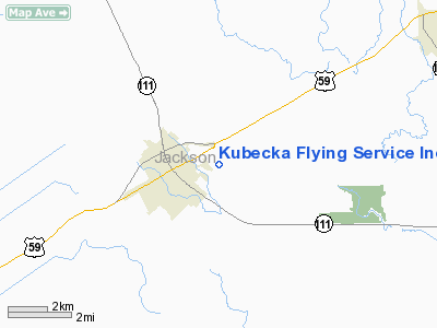
Kubecka Flying Service Inc. Airport |
Location & QuickFacts
| FAA Information Effective: | 2008-09-25 |
| Airport Identifier: | 6TE5 |
| Airport Status: | Operational |
| Longitude/Latitude: | 096-37-18.9130W/28-58-50.9400N
-96.621920/28.980817 (Estimated) |
| Elevation: | 65 ft / 19.81 m (Estimated) |
| Land: | 0 acres |
| From nearest city: | 1 nautical miles E of Edna, TX |
| Location: | Jackson County, TX |
| Magnetic Variation: | 06E (1985) |
Owner & Manager
| Ownership: | Privately owned |
| Owner: | Daniel P. Kubecka |
| Address: | Drawer V
Edna, TX 77957 |
| Phone number: | 512-782-2141 |
| Manager: | Dan Kubecka |
| Address: | Drawer V
Edna, TX 77957 |
| Phone number: | 512-782-2141 |
Airport Operations and Facilities
| Airport Use: | Private |
| Wind indicator: | No |
| Segmented Circle: | No |
| Control Tower: | No |
| Landing fee charge: | No |
| Sectional chart: | Houston |
| Region: | ASW - Southwest |
| Boundary ARTCC: | ZHU - Houston |
| Tie-in FSS: | CXO - Montgomery County |
| FSS on Airport: | No |
| FSS Toll Free: | 1-800-WX-BRIEF |
Airport Services
| Airframe Repair: | NONE |
| Power Plant Repair: | NONE |
Runway Information
Runway 14/32
| Dimension: | 5440 x 65 ft / 1658.1 x 19.8 m |
| Surface: | TURF, Fair Condition |
| |
Runway 14 |
Runway 32 |
| Traffic Pattern: | Left | Left |
| Obstruction: | 25 ft bldg, 100 ft right of centerline | 6 ft brush, 0.0 ft from runway, 20 ft left of centerline |
|
Radio Navigation Aids
| ID |
Type |
Name |
Ch |
Freq |
Var |
Dist |
| PKV | NDB | Port Lavaca | | 515.00 | 05E | 20.1 nm |
| ARM | NDB | Wharton | | 245.00 | 06E | 29.7 nm |
| OKT | NDB | Yoakum | | 350.00 | 06E | 33.6 nm |
| BYY | NDB | Bay City | | 344.00 | 06E | 40.1 nm |
| VCT | VOR/DME | Victoria | 027X | 109.00 | 06E | 19.4 nm |
| ELA | VOR/DME | Eagle Lake | 111X | 116.40 | 08E | 44.0 nm |
| PSX | VORTAC | Palacios | 120X | 117.30 | 08E | 21.1 nm |
Images and information placed above are from
http://www.airport-data.com/airport/6TE5/
We thank them for the data!
| General Info
|
| Country |
United States
|
| State |
TEXAS
|
| FAA ID |
6TE5
|
| Latitude |
28-58-50.940N
|
| Longitude |
096-37-18.913W
|
| Elevation |
65 feet
|
| Near City |
EDNA
|
We don't guarantee the information is fresh and accurate. The data may
be wrong or outdated.
For more up-to-date information please refer to other sources.
|
|


