 |
|
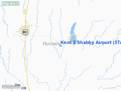
Location & QuickFacts
| FAA Information Effective: | 2008-09-25 |
| Airport Identifier: | 5TA6 |
| Airport Status: | Operational |
| Longitude/Latitude: | 099-53-39.6000W/31-56-03.9000N
-99.894333/31.934417 (Estimated) |
| Elevation: | 1820 ft / 554.74 m (Estimated) |
| Land: | 0 acres |
| From nearest city: | 3 nautical miles E of Winters, TX |
| Location: | Runnels County, TX |
| Magnetic Variation: | 07E (1995) |
Owner & Manager
| Ownership: | Privately owned |
| Owner: | Sterling Brooks |
| Address: | 210 Pr 432
Winters, TX 79567 |
| Phone number: | 915-754-4609 |
| Manager: | Sterling Brooks |
| Address: | 210 Pr 432
Winters, TX 79567 |
| Phone number: | 915-754-4609 |
Airport Operations and Facilities
| Airport Use: | Private |
| Wind indicator: | Yes |
| Segmented Circle: | No |
| Control Tower: | No |
| Sectional chart: | San Antonio |
| Region: | ASW - Southwest |
| Boundary ARTCC: | ZFW - Fort Worth |
| Tie-in FSS: | SJT - San Angelo |
| FSS on Airport: | No |
| FSS Toll Free: | 1-800-WX-BRIEF |
Runway Information
Runway 17/35
| Dimension: | 2600 x 90 ft / 792.5 x 27.4 m |
| Surface: | TURF, |
| |
Runway 17 |
Runway 35 |
| Traffic Pattern: | Left | Left |
| Obstruction: | 29 ft pline, 600.0 ft from runway | 4 ft fence, 90.0 ft from runway |
|
Radio Navigation Aids
| ID |
Type |
Name |
Ch |
Freq |
Var |
Dist |
| IEW | NDB | Winters | | 396.00 | 08E | 4.8 nm |
| UBC | NDB | Ballinger | | 239.00 | 08E | 15.8 nm |
| COM | NDB | Coleman | | 385.00 | 07E | 25.5 nm |
| SWW | NDB | Sweetwater | | 275.00 | 08E | 43.0 nm |
| DYS | TACAN | Dyess | 063X | | 08E | 29.2 nm |
| TQA | VOR/DME | Tuscola | 053X | 111.60 | 10E | 18.5 nm |
| BWD | VOR/DME | Brownwood | 023X | 108.60 | 08E | 47.9 nm |
| ABI | VORTAC | Abilene | 084X | 113.70 | 10E | 32.9 nm |
| SJT | VORTAC | San Angelo | 098X | 115.10 | 10E | 44.2 nm |
Images and information placed above are from
http://www.airport-data.com/airport/5TA6/
We thank them for the data!
| General Info
|
| Country |
United States
|
| State |
TEXAS
|
| FAA ID |
5TA6
|
| Latitude |
31-56-03.900N
|
| Longitude |
099-53-39.600W
|
| Elevation |
1820 feet
|
| Near City |
WINTERS
|
We don't guarantee the information is fresh and accurate. The data may
be wrong or outdated.
For more up-to-date information please refer to other sources.
|
|


