 |
|
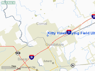
Kitty Hawk Flying Field Ultralight Airport |
Location & QuickFacts
| FAA Information Effective: | 2008-09-25 |
| Airport Identifier: | TS67 |
| Airport Status: | Operational |
| Longitude/Latitude: | 098-16-41.0440W/29-37-30.8160N
-98.278068/29.625227 (Estimated) |
| Elevation: | 860 ft / 262.13 m (Estimated) |
| Land: | 57 acres |
| From nearest city: | 1 nautical miles SE of Garden Ridge, TX |
| Location: | Comal County, TX |
| Magnetic Variation: | 07E (1984) |
Owner & Manager
| Ownership: | Privately owned |
| Owner: | Houston St Enterpr. Inc. |
| Address: | 211 Alamo Plaza
San Antonio, TX 78205 |
| Phone number: | 512-223-1523 |
| Address: |
|
Airport Operations and Facilities
| Airport Use: | Private |
| Wind indicator: | Yes |
| Segmented Circle: | No |
| Control Tower: | No |
| Sectional chart: | San Antonio |
| Region: | ASW - Southwest |
| Boundary ARTCC: | ZHU - Houston |
| Tie-in FSS: | SJT - San Angelo |
| FSS Toll Free: | 1-800-WX-BRIEF |
Runway Information
Runway 14/32
| Dimension: | 700 x 20 ft / 213.4 x 6.1 m |
| Surface: | ASPH, |
| |
Runway 14 |
Runway 32 |
| Traffic Pattern: | Left | Left |
| Markings: | Basic, | Basic, |
|
Radio Navigation Aids
| ID |
Type |
Name |
Ch |
Freq |
Var |
Dist |
| CVB | NDB | Castroville | | 338.00 | 08E | 34.3 nm |
| ER | NDB | Shein | | 263.00 | 08E | 41.9 nm |
| PEZ | NDB | Pleasanton | | 275.00 | 07E | 42.2 nm |
| HHH | NDB | Devine | | 359.00 | 07E | 45.3 nm |
| HMA | NDB | Hondo | | 329.00 | 08E | 49.2 nm |
| DHK | TACAN | Randolph | 036X | | 09E | 5.3 nm |
| KSY | TACAN | Kelly | 057X | | 07E | 21.2 nm |
| SSF | VOR | Stinson | | 108.40 | 09E | 23.7 nm |
| HDO | VOR/DME | Hondo | 31X | 109.40 | 08E | 49.9 nm |
| RND | VORTAC | Randolph | 70X | 112.30 | 09E | 6.4 nm |
| SAT | VORTAC | San Antonio | 115X | 116.80 | 08E | 9.6 nm |
| STV | VORTAC | Stonewall | 085X | 113.80 | 08E | 41.5 nm |
| SAT | VOT | San Antonio Intl | | 110.40 | | 11.4 nm |
Remarks
Images and information placed above are from
http://www.airport-data.com/airport/TS67/
We thank them for the data!
| General Info
|
| Country |
United States
|
| State |
TEXAS
|
| FAA ID |
TS67
|
| Latitude |
29-37-30.816N
|
| Longitude |
098-16-41.044W
|
| Elevation |
860 feet
|
| Near City |
GARDEN RIDGE
|
We don't guarantee the information is fresh and accurate. The data may
be wrong or outdated.
For more up-to-date information please refer to other sources.
|
|


