 |
|
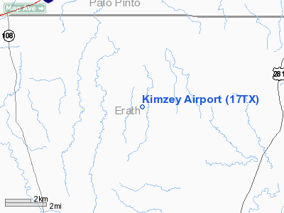
Location & QuickFacts
| FAA Information Effective: | 2008-09-25 |
| Airport Identifier: | 17TX |
| Airport Status: | Operational |
| Longitude/Latitude: | 098-15-18.1600W/32-26-55.4810N
-98.255044/32.448745 (Estimated) |
| Elevation: | 1100 ft / 335.28 m (Estimated) |
| Land: | 0 acres |
| From nearest city: | 12 nautical miles N of Stephenville, TX |
| Location: | Erath County, TX |
| Magnetic Variation: | 07E (1985) |
Owner & Manager
| Ownership: | Privately owned |
| Owner: | Kimzey Ranch |
| Address: | Rt 2 Box 179
Stephenville, TX 76401 |
| Phone number: | 254-968-4994 |
| Manager: | John P. Kimzey |
| Address: | Rt 2 Box 179
Stephenville, TX 76401 |
| Phone number: | 254-968-4994 |
Airport Operations and Facilities
| Airport Use: | Private |
| Wind indicator: | Yes |
| Segmented Circle: | No |
| Control Tower: | No |
| Landing fee charge: | No |
| Sectional chart: | Dallas-ft Worth |
| Region: | ASW - Southwest |
| Boundary ARTCC: | ZFW - Fort Worth |
| Tie-in FSS: | FTW - Fort Worth |
| FSS on Airport: | No |
| FSS Phone: | 817-541-3474 |
| FSS Toll Free: | 1-800-WX-BRIEF |
Runway Information
Runway 17/35
| Dimension: | 3200 x 30 ft / 975.4 x 9.1 m |
| Surface: | ASPH, |
| |
Runway 17 |
Runway 35 |
| Traffic Pattern: | Left | Left |
|
Radio Navigation Aids
| ID |
Type |
Name |
Ch |
Freq |
Var |
Dist |
| MWL | NDB | Mineral Wells | | 266.00 | 06E | 22.6 nm |
| OIP | NDB | Old Rip | | 410.00 | 07E | 28.3 nm |
| GZV | NDB | Brazos River | | 280.00 | 07E | 31.3 nm |
| BKD | NDB | Breckenridge | | 245.00 | 07E | 36.9 nm |
| GHX | NDB | Graham | | 371.00 | 07E | 44.8 nm |
| NFW | TACAN | Nas Jrb Fort Worth | 024X | | 07E | 45.6 nm |
| BWD | VOR/DME | Brownwood | 023X | 108.60 | 08E | 48.9 nm |
| MQP | VORTAC | Millsap | 124X | 117.70 | 09E | 21.2 nm |
| JEN | VORTAC | Glen Rose | 097X | 115.00 | 06E | 25.9 nm |
Images and information placed above are from
http://www.airport-data.com/airport/17TX/
We thank them for the data!
| General Info
|
| Country |
United States
|
| State |
TEXAS
|
| FAA ID |
17TX
|
| Latitude |
32-26-55.481N
|
| Longitude |
098-15-18.160W
|
| Elevation |
1100 feet
|
| Near City |
STEPHENVILLE
|
We don't guarantee the information is fresh and accurate. The data may
be wrong or outdated.
For more up-to-date information please refer to other sources.
|
|


