 |
|
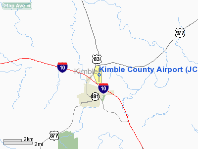
Location & QuickFacts
| FAA Information Effective: | 2008-09-25 |
| Airport Identifier: | JCT |
| Airport Status: | Operational |
| Longitude/Latitude: | 099-45-48.4390W/30-30-40.5360N
-99.763455/30.511260 (Estimated) |
| Elevation: | 1749 ft / 533.10 m (Surveyed) |
| Land: | 195 acres |
| From nearest city: | 1 nautical miles NE of Junction, TX |
| Location: | Kimble County, TX |
| Magnetic Variation: | 08E (1985) |
Owner & Manager
| Ownership: | Publicly owned |
| Owner: | Kimble County |
| Address: | Kimble County Courthouse, 501 Main
Junction, TX 76849 |
| Phone number: | 325-446-2724 |
| Manager: | Bill Davis |
| Address: | 635 Airport Road, 501 Main
Junction, TX 76849 |
| Phone number: | 325-446-2820 |
Airport Operations and Facilities
| Airport Use: | Open to public |
| Wind indicator: | Yes |
| Segmented Circle: | Yes |
| Control Tower: | No |
| Lighting Schedule: | DUSK-DAWN
MIRL RY 17/35 PRESET LOW INTST, TO INCR INTST ACTVT - CTAF. |
| Beacon Color: | Clear-Green (lighted land airport) |
| Landing fee charge: | No |
| Sectional chart: | San Antonio |
| Region: | ASW - Southwest |
| Boundary ARTCC: | ZHU - Houston |
| Tie-in FSS: | SJT - San Angelo |
| FSS on Airport: | No |
| FSS Toll Free: | 1-800-WX-BRIEF |
| NOTAMs Facility: | JCT (NOTAM-d service avaliable) |
| Federal Agreements: | NGY |
Airport Communications
| CTAF: | 122.800 |
| Unicom: | 122.800 |
Airport Services
| Fuel available: | 100LLA+ |
| Airframe Repair: | MAJOR |
| Power Plant Repair: | MAJOR |
| Bottled Oxygen: | NONE |
| Bulk Oxygen: | NONE |
Runway Information
Runway 08/26
| Dimension: | 2255 x 146 ft / 687.3 x 44.5 m |
| Surface: | TURF, Fair Condition |
| |
Runway 08 |
Runway 26 |
| Longitude: | 099-45-49.4700W | 099-45-23.7400W |
| Latitude: | 30-30-43.1400N | 30-30-42.1800N |
| Elevation: | 0.00 ft | 1691.00 ft |
| Alignment: | 92 | 127 |
| Traffic Pattern: | Left | Left |
| Obstruction: | , 50:1 slope to clear | 30 ft trees, 400.0 ft from runway, 120 ft right of centerline, 13:1 slope to clear |
|
Runway 17/35
| Dimension: | 5000 x 75 ft / 1524.0 x 22.9 m |
| Surface: | ASPH, Good Condition |
| Weight Limit: | Single wheel: 30000 lbs. |
| Edge Lights: | Medium |
| |
Runway 17 |
Runway 35 |
| Longitude: | 099-45-51.7940W | 099-45-52.0960W |
| Latitude: | 30-31-01.7510N | 30-30-15.7200N |
| Elevation: | 1749.00 ft | 1701.00 ft |
| Alignment: | 127 | 0 |
| Traffic Pattern: | Left | Left |
| Markings: | Non-precision instrument, Good Condition | Non-precision instrument, Good Condition |
| Obstruction: | 200 ft hill, 4400.0 ft from runway, 21:1 slope to clear | 40 ft trees, 1560.0 ft from runway, 215 ft left of centerline, 34:1 slope to clear |
|
Radio Navigation Aids
| ID |
Type |
Name |
Ch |
Freq |
Var |
Dist |
| SOA | NDB | Sonora | | 371.00 | 08E | 45.9 nm |
| BBD | NDB | Brady | | 380.00 | 07E | 46.1 nm |
| JCT | VORTAC | Junction | 107X | 116.00 | 08E | 5.9 nm |
| RSG | VORTAC | Rocksprings | 049X | 111.20 | 10E | 40.8 nm |
| CSI | VORTAC | Center Point | 122X | 117.50 | 08E | 45.5 nm |
Remarks
- PAEW ON TWY AND ADJ RY.
- FREQUENT MILITARY TRAINING FLIGHTS CONDUCTING LOW APPROACHES TO AIRPORT.
Images and information placed above are from
http://www.airport-data.com/airport/JCT/
We thank them for the data!
| General Info
|
| Country |
United States
|
| State |
TEXAS
|
| FAA ID |
JCT
|
| Latitude |
30-30-40.536N
|
| Longitude |
099-45-48.439W
|
| Elevation |
1749 feet
|
| Near City |
JUNCTION
|
We don't guarantee the information is fresh and accurate. The data may
be wrong or outdated.
For more up-to-date information please refer to other sources.
|
|


