 |
|
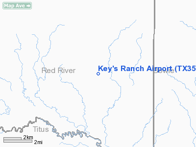
Location & QuickFacts
| FAA Information Effective: | 2008-09-25 |
| Airport Identifier: | TX35 |
| Airport Status: | Operational |
| Longitude/Latitude: | 094-48-50.7660W/33-26-35.4080N
-94.814102/33.443169 (Estimated) |
| Elevation: | 345 ft / 105.16 m (Estimated) |
| Land: | 0 acres |
| From nearest city: | 4 nautical miles SE of Boxelder/lydia, TX |
| Location: | Red River County, TX |
| Magnetic Variation: | 05E (1985) |
Owner & Manager
| Ownership: | Privately owned |
| Owner: | Key's Estate - G.t. Key Ii |
| Address: | Route 1, Box 144
Avery, TX 75554 |
| Phone number: | 214-684-3359 |
| Manager: | G T Key Ii |
| Address: | Route 1, Box 144
Avery, TX 75554 |
| Phone number: | 214-684-3359 |
Airport Operations and Facilities
| Airport Use: | Private |
| Wind indicator: | No |
| Segmented Circle: | No |
| Control Tower: | No |
| Landing fee charge: | No |
| Sectional chart: | Memphis |
| Region: | ASW - Southwest |
| Boundary ARTCC: | ZFW - Fort Worth |
| Tie-in FSS: | FTW - Fort Worth |
| FSS on Airport: | No |
| FSS Phone: | 817-541-3474 |
| FSS Toll Free: | 1-800-WX-BRIEF |
Airport Services
| Airframe Repair: | NONE |
| Power Plant Repair: | NONE |
Runway Information
Runway 17/35
| Dimension: | 3075 x 63 ft / 937.3 x 19.2 m |
| Surface: | TURF, |
| |
Runway 17 |
Runway 35 |
| Traffic Pattern: | Left | Left |
|
Radio Navigation Aids
| ID |
Type |
Name |
Ch |
Freq |
Var |
Dist |
| IBO | NDB | Idabel | | 271.00 | 03E | 27.9 nm |
| LST | NDB | Lone Star | | 305.00 | 05E | 31.2 nm |
| ATA | NDB | Atlanta | | 347.00 | 04E | 37.4 nm |
| DEQ | NDB | De Queen | | 281.00 | 04E | 41.7 nm |
| PRX | VOR/DME | Paris | 083X | 113.60 | 07E | 32.3 nm |
| SLR | VOR/DME | Sulphur Springs | 027X | 109.00 | 08E | 39.4 nm |
| UIM | VOR/DME | Quitman | 087X | 114.00 | 08E | 43.8 nm |
| TXK | VORTAC | Texarkana | 110X | 116.30 | 07E | 37.4 nm |
Images and information placed above are from
http://www.airport-data.com/airport/TX35/
We thank them for the data!
| General Info
|
| Country |
United States
|
| State |
TEXAS
|
| FAA ID |
TX35
|
| Latitude |
33-26-35.408N
|
| Longitude |
094-48-50.766W
|
| Elevation |
345 feet
|
| Near City |
BOXELDER/LYDIA
|
We don't guarantee the information is fresh and accurate. The data may
be wrong or outdated.
For more up-to-date information please refer to other sources.
|
|


