 |
|
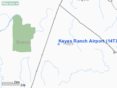
Location & QuickFacts
| FAA Information Effective: | 2008-09-25 |
| Airport Identifier: | 14TX |
| Airport Status: | Operational |
| Longitude/Latitude: | 098-10-26.0540W/30-17-21.7260N
-98.173904/30.289368 (Estimated) |
| Elevation: | 1150 ft / 350.52 m (Estimated) |
| Land: | 0 acres |
| From nearest city: | 8 nautical miles NW of Dripping Springs, TX |
| Location: | Hays County, TX |
| Magnetic Variation: | 07E (1985) |
Owner & Manager
| Ownership: | Privately owned |
| Owner: | William O. Keyes |
| Address: | 15209 Rainbow One
Austin, TX 78734 |
| Phone number: | 512-266-3081 |
| Address: |
|
Airport Operations and Facilities
| Airport Use: | Private |
| Wind indicator: | Yes |
| Segmented Circle: | No |
| Control Tower: | No |
| Sectional chart: | San Antonio |
| Region: | ASW - Southwest |
| Boundary ARTCC: | ZHU - Houston |
| Tie-in FSS: | SJT - San Angelo |
| FSS on Airport: | No |
| FSS Toll Free: | 1-800-WX-BRIEF |
Runway Information
Runway 16/34
| Dimension: | 2000 x 40 ft / 609.6 x 12.2 m |
| Surface: | ASPH, |
| |
Runway 16 |
Runway 34 |
| Traffic Pattern: | Left | Left |
|
Radio Navigation Aids
| ID |
Type |
Name |
Ch |
Freq |
Var |
Dist |
| MFS | NDB | Horseshoe Bay Resort | | 403.00 | 07E | 17.0 nm |
| BMQ | NDB | Burnet | | 341.00 | 07E | 27.3 nm |
| GUO | NDB | Georgetown | | 332.00 | 06E | 34.9 nm |
| ER | NDB | Shein | | 263.00 | 08E | 48.9 nm |
| DHK | TACAN | Randolph | 036X | | 09E | 45.5 nm |
| GRK | VOR/DME | Gray | 055X | 111.80 | 07E | 48.4 nm |
| STV | VORTAC | Stonewall | 085X | 113.80 | 08E | 28.1 nm |
| CWK | VORTAC | Centex | 075X | 112.80 | 06E | 33.8 nm |
| SAT | VORTAC | San Antonio | 115X | 116.80 | 08E | 41.6 nm |
| LLO | VORTAC | Llano | 019X | 108.20 | 08E | 44.0 nm |
| RND | VORTAC | Randolph | 70X | 112.30 | 09E | 46.7 nm |
| SAT | VOT | San Antonio Intl | | 110.40 | | 48.0 nm |
Images and information placed above are from
http://www.airport-data.com/airport/14TX/
We thank them for the data!
| General Info
|
| Country |
United States
|
| State |
TEXAS
|
| FAA ID |
14TX
|
| Latitude |
30-17-21.726N
|
| Longitude |
098-10-26.054W
|
| Elevation |
1150 feet
|
| Near City |
DRIPPING SPRINGS
|
We don't guarantee the information is fresh and accurate. The data may
be wrong or outdated.
For more up-to-date information please refer to other sources.
|
|


