 |
|
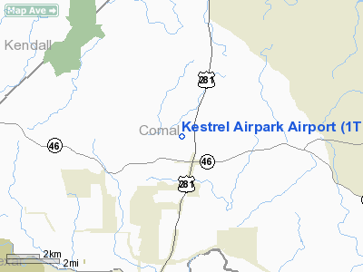
Location & QuickFacts
| FAA Information Effective: | 2008-09-25 |
| Airport Identifier: | 1T7 |
| Airport Status: | Operational |
| Longitude/Latitude: | 098-25-33.9030W/29-48-42.4260N
-98.426084/29.811785 (Estimated) |
| Elevation: | 1250 ft / 381.00 m (Estimated) |
| Land: | 25 acres |
| From nearest city: | 23 nautical miles N of San Antonio, TX |
| Location: | Comal County, TX |
| Magnetic Variation: | 07E (1995) |
Owner & Manager
| Ownership: | Privately owned |
| Owner: | Kestrel Airpark Runway Association |
| Address: | 150 Flightline Drive
San Antonio, TX 78209 |
| Phone number: | 830-890-5660 |
| Manager: | John M Wallace
CHAIRMAN OF THE BOARD. |
| Address: | 290 Stealth Drive
San Antonio, TX 78209 |
| Phone number: | 830-980-5660 |
Airport Operations and Facilities
| Airport Use: | Open to public |
| Wind indicator: | Yes |
| Segmented Circle: | Yes |
| Control Tower: | No |
| Lighting Schedule: | DUSK-DAWN |
| Sectional chart: | San Antonio |
| Region: | ASW - Southwest |
| Boundary ARTCC: | ZHU - Houston |
| Tie-in FSS: | SJT - San Angelo |
| FSS Toll Free: | 1-800-WX-BRIEF |
| NOTAMs Facility: | SJT (NOTAM-d service avaliable) |
Airport Communications
| CTAF: | 122.975 |
| Unicom: | 122.975 |
Airport Services
| Fuel available: | 100LL |
| Airframe Repair: | MINOR |
| Power Plant Repair: | MINOR |
Runway Information
Runway 12/30
| Dimension: | 3000 x 40 ft / 914.4 x 12.2 m |
| Surface: | ASPH, Good Condition |
| Edge Lights: | Non-standard lighting system
NSTD LIRL; RY 12 LGTS NOT AT THLD. |
| |
Runway 12 |
Runway 30 |
| Traffic Pattern: | Left | Right |
| Markings: | Nonstandard, Good Condition
RY 12/30 NRS 30 FT HIGH. | Nonstandard, Good Condition |
| Obstruction: | 20 ft trees, 295.0 ft from runway, 30 ft left of centerline, 4:1 slope to clear
+10 FT ROAD AT THLD 70 FT LEFT, +30 FT TREES AT THLD 112 FT L, +30 FT TREES 70 FT FM THLD 55 FT L. | 24 ft trees, 200.0 ft from runway
+10 FT ROAD AT THLD 68 FT LEFT. |
|
Radio Navigation Aids
| ID |
Type |
Name |
Ch |
Freq |
Var |
Dist |
| ER | NDB | Shein | | 263.00 | 08E | 31.0 nm |
| CVB | NDB | Castroville | | 338.00 | 08E | 35.7 nm |
| MFS | NDB | Horseshoe Bay Resort | | 403.00 | 07E | 42.9 nm |
| HMA | NDB | Hondo | | 329.00 | 08E | 47.1 nm |
| HHH | NDB | Devine | | 359.00 | 07E | 48.6 nm |
| DHK | TACAN | Randolph | 036X | | 09E | 18.5 nm |
| KSY | TACAN | Kelly | 057X | | 07E | 26.5 nm |
| SSF | VOR | Stinson | | 108.40 | 09E | 33.3 nm |
| HDO | VOR/DME | Hondo | 31X | 109.40 | 08E | 48.1 nm |
| SAT | VORTAC | San Antonio | 115X | 116.80 | 08E | 10.2 nm |
| RND | VORTAC | Randolph | 70X | 112.30 | 09E | 19.1 nm |
| STV | VORTAC | Stonewall | 085X | 113.80 | 08E | 27.8 nm |
| CSI | VORTAC | Center Point | 122X | 117.50 | 08E | 41.6 nm |
| SAT | VOT | San Antonio Intl | | 110.40 | | 16.9 nm |
Remarks
- DEER ON & INVOF RY.
- TGL AND LOW APCHS PROHIBITED FOR TRANSIENT & COMMERICAL ACFTS. TKOFS RSTRD BTN 2200-0600.
- PRVDD RIGHT HAND TFC IS USED FOR RY 30 DUE TO RAPID RISING TERRAIN WEST OF RYS.
Images and information placed above are from
http://www.airport-data.com/airport/1T7/
We thank them for the data!
| General Info
|
| Country |
United States
|
| State |
TEXAS
|
| FAA ID |
1T7
|
| Latitude |
29-48-45.790N
|
| Longitude |
098-25-31.060W
|
| Elevation |
1250 feet
|
| Near City |
SAN ANTONIO
|
We don't guarantee the information is fresh and accurate. The data may
be wrong or outdated.
For more up-to-date information please refer to other sources.
|
|


