 |
|
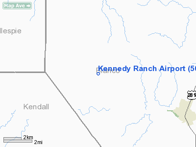
Location & QuickFacts
| FAA Information Effective: | 2008-09-25 |
| Airport Identifier: | 50TX |
| Airport Status: | Operational |
| Longitude/Latitude: | 098-31-31.3600W/30-08-15.4500N
-98.525378/30.137625 (Estimated) |
| Elevation: | 1598 ft / 487.07 m (Estimated) |
| Land: | 25 acres |
| From nearest city: | 6 nautical miles W of Blanco, TX |
| Location: | Blanco County, TX |
| Magnetic Variation: | 03E (1990) |
Owner & Manager
| Ownership: | Privately owned |
| Owner: | Steve Kennedy |
| Address: | Po Box 820124
Dallas, TX 75382 |
| Phone number: | 214-368-6050 |
| Manager: | Steve Kennedy |
| Address: | Po Box 820124
Dallas, TX 75382 |
| Phone number: | 214-368-6050 |
Airport Operations and Facilities
| Airport Use: | Private |
| Wind indicator: | Yes |
| Segmented Circle: | No |
| Control Tower: | No |
| Sectional chart: | Houston |
| Region: | ASW - Southwest |
| Boundary ARTCC: | ZHU - Houston |
| Tie-in FSS: | SJT - San Angelo |
| FSS on Airport: | No |
| FSS Toll Free: | 1-800-WX-BRIEF |
Runway Information
Runway 13/31
| Dimension: | 3500 x 40 ft / 1066.8 x 12.2 m |
| Surface: | ASPH, |
| |
Runway 13 |
Runway 31 |
| Traffic Pattern: | Left | Left |
| Obstruction: | 7 ft fence, 20.0 ft from runway | 30 ft trees, 250.0 ft from runway |
|
Radio Navigation Aids
| ID |
Type |
Name |
Ch |
Freq |
Var |
Dist |
| MFS | NDB | Horseshoe Bay Resort | | 403.00 | 07E | 24.8 nm |
| ER | NDB | Shein | | 263.00 | 08E | 28.5 nm |
| BMQ | NDB | Burnet | | 341.00 | 07E | 39.2 nm |
| DHK | TACAN | Randolph | 036X | | 09E | 38.5 nm |
| KSY | TACAN | Kelly | 057X | | 07E | 44.9 nm |
| STV | VORTAC | Stonewall | 085X | 113.80 | 08E | 10.3 nm |
| SAT | VORTAC | San Antonio | 115X | 116.80 | 08E | 29.9 nm |
| CSI | VORTAC | Center Point | 122X | 117.50 | 08E | 38.1 nm |
| RND | VORTAC | Randolph | 70X | 112.30 | 09E | 39.2 nm |
| LLO | VORTAC | Llano | 019X | 108.20 | 08E | 41.9 nm |
| SAT | VOT | San Antonio Intl | | 110.40 | | 36.4 nm |
Images and information placed above are from
http://www.airport-data.com/airport/50TX/
We thank them for the data!
| General Info
|
| Country |
United States
|
| State |
TEXAS
|
| FAA ID |
50TX
|
| Latitude |
30-08-15.450N
|
| Longitude |
098-31-31.360W
|
| Elevation |
1598 feet
|
| Near City |
BLANCO
|
We don't guarantee the information is fresh and accurate. The data may
be wrong or outdated.
For more up-to-date information please refer to other sources.
|
|


