 |
|
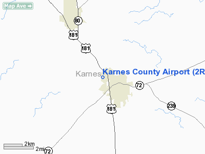
Location & QuickFacts
| FAA Information Effective: | 2008-09-25 |
| Airport Identifier: | 2R9 |
| Airport Status: | Operational |
| Longitude/Latitude: | 097-51-56.1000W/28-49-30.0270N
-97.865583/28.825008 (Estimated) |
| Elevation: | 289 ft / 88.09 m (Surveyed) |
| Land: | 261 acres |
| From nearest city: | 1 nautical miles NW of Kenedy, TX |
| Location: | Karnes County, TX |
| Magnetic Variation: | 08E (1980) |
Owner & Manager
| Ownership: | Publicly owned |
| Owner: | City Of Kenedy |
| Address: | 303 W.main
Kenedy, TX 78119 |
| Phone number: | 830-583-2230 |
| Manager: | Randy Garza
MAYOR |
| Address: | 303 W.main
Kenedy, TX 78119 |
| Phone number: | 830-583-6400 |
Airport Operations and Facilities
| Airport Use: | Open to public |
| Wind indicator: | Yes |
| Segmented Circle: | Yes |
| Control Tower: | No |
| Lighting Schedule: | DUSK-DAWN
MIRL RY 16/34 & TWY LGTS PRESET LOW INTST; TO INCR INTST ACTVT - CTAF. |
| Beacon Color: | Clear-Green (lighted land airport) |
| Landing fee charge: | No |
| Sectional chart: | San Antonio |
| Region: | ASW - Southwest |
| Boundary ARTCC: | ZHU - Houston |
| Tie-in FSS: | SJT - San Angelo |
| FSS on Airport: | No |
| FSS Toll Free: | 1-800-WX-BRIEF |
| NOTAMs Facility: | SJT (NOTAM-d service avaliable) |
| Federal Agreements: | NGY |
Airport Communications
| CTAF: | 123.000 |
| Unicom: | 123.000 |
Airport Services
| Airframe Repair: | MAJOR |
| Power Plant Repair: | MAJOR |
Runway Information
Runway 16/34
| Dimension: | 3218 x 60 ft / 980.8 x 18.3 m |
| Surface: | ASPH, Fair Condition |
| Weight Limit: | Single wheel: 11000 lbs. |
| Edge Lights: | Medium |
| |
Runway 16 |
Runway 34 |
| Longitude: | 097-51-59.4040W | 097-51-52.6880W |
| Latitude: | 28-49-45.6020N | 28-49-14.2950N |
| Elevation: | 289.00 ft | 272.00 ft |
| Alignment: | 127 | 127 |
| Traffic Pattern: | Right | Left |
| Markings: | Basic, Fair Condition | Basic, Fair Condition |
| Obstruction: | 26 ft trees, 475.0 ft from runway, 76 ft left of centerline, 10:1 slope to clear
+6 FT DIRT ROAD 144 FT FM THLD; +8 FT TREE 173 FT FM THLD 10 FT R. | 15 ft trees, 583.0 ft from runway, 25:1 slope to clear |
|
Radio Navigation Aids
| ID |
Type |
Name |
Ch |
Freq |
Var |
Dist |
| BEA | NDB | Beeville | | 284.00 | 07E | 27.7 nm |
| PEZ | NDB | Pleasanton | | 275.00 | 07E | 35.2 nm |
| MNO | NDB | Mellon Ranch | | 375.00 | 06E | 47.8 nm |
| OKT | NDB | Yoakum | | 350.00 | 06E | 48.1 nm |
| DHK | TACAN | Randolph | 036X | | 09E | 47.7 nm |
| SSF | VOR | Stinson | | 108.40 | 09E | 40.0 nm |
| VCT | VOR/DME | Victoria | 027X | 109.00 | 06E | 46.9 nm |
| THX | VORTAC | Three Rivers | 051X | 111.40 | 08E | 24.4 nm |
| RND | VORTAC | Randolph | 70X | 112.30 | 09E | 47.2 nm |
Remarks
- DEER ON & INVOF ARPT (SEASONAL).
Images and information placed above are from
http://www.airport-data.com/airport/2R9/
We thank them for the data!
| General Info
|
| Country |
United States
|
| State |
TEXAS
|
| FAA ID |
2R9
|
| Latitude |
28-49-30.027N
|
| Longitude |
097-51-56.100W
|
| Elevation |
289 feet
|
| Near City |
KENEDY
|
We don't guarantee the information is fresh and accurate. The data may
be wrong or outdated.
For more up-to-date information please refer to other sources.
|
|


