 |
|
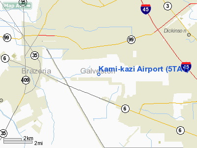
Location & QuickFacts
| FAA Information Effective: | 2008-09-25 |
| Airport Identifier: | 5TA7 |
| Airport Status: | Operational |
| Longitude/Latitude: | 095-09-32.7530W/29-25-14.8450N
-95.159098/29.420790 (Estimated) |
| Elevation: | 25 ft / 7.62 m (Estimated) |
| Land: | 35 acres |
| From nearest city: | 3 nautical miles NW of Santa Fe, TX |
| Location: | Galveston County, TX |
| Magnetic Variation: | 06E (1985) |
Owner & Manager
| Ownership: | Privately owned |
| Owner: | James P. Entrekin |
| Address: | Route 6, Box 695-d
Alvin, TX 77511 |
| Phone number: | 409-925-5391 |
| Manager: | James P. Entrekin |
| Address: | Route 6, Box 695-d
Alvin, TX 77511 |
| Phone number: | 409-925-5391 |
Airport Operations and Facilities
| Airport Use: | Private |
| Wind indicator: | No |
| Segmented Circle: | No |
| Control Tower: | No |
| Landing fee charge: | No |
| Sectional chart: | Houston |
| Region: | ASW - Southwest |
| Boundary ARTCC: | ZHU - Houston |
| Tie-in FSS: | CXO - Montgomery County |
| FSS on Airport: | No |
| FSS Toll Free: | 1-800-WX-BRIEF
FOR FP FILING CALL CXO FSS 1-800-833-5602. |
Runway Information
Runway 18/36
| Dimension: | 1400 x 75 ft / 426.7 x 22.9 m |
| Surface: | TURF, |
| |
Runway 18 |
Runway 36 |
| Traffic Pattern: | Left | Left |
|
Radio Navigation Aids
| ID |
Type |
Name |
Ch |
Freq |
Var |
Dist |
| JPA | NDB | Sanjac | | 347.00 | 05E | 15.6 nm |
| SYG | NDB | Sandy Point | | 402.00 | 05E | 16.9 nm |
| GLS | NDB | Galveston | | 206.00 | 08E | 21.7 nm |
| SGR | NDB | Hull | | 388.00 | 05E | 28.9 nm |
| CBC | NDB | Anahuac | | 413.00 | 05E | 33.5 nm |
| BVP | NDB | Nixin | | 326.00 | 05E | 34.5 nm |
| LYD | NDB | Lakeside | | 249.00 | 05E | 36.0 nm |
| EYQ | NDB | Weiser | | 286.00 | 06E | 39.8 nm |
| BYY | NDB | Bay City | | 344.00 | 06E | 45.6 nm |
| DWH | NDB | David Hooks | | 521.00 | 05E | 47.4 nm |
| EFD | TACAN | Ellington | 031X | | 05E | 11.1 nm |
| HUB | VOR/DME | Hobby | 118X | 117.10 | 05E | 15.4 nm |
| MHF | VOR/DME | Trinity | 083X | 113.60 | 07E | 22.8 nm |
| VUH | VORTAC | Scholes | 077X | 113.00 | 06E | 17.8 nm |
| IAH | VORTAC | Humble | 113X | 116.60 | 05E | 33.7 nm |
| HOU | VOT | Houston Wm P Hobby | | 108.40 | | 14.9 nm |
Remarks
- ALTA-LOMA & ARCADIA COMBINED TO FORM THE CITY OF SANTA FE, TEXAS. SAME TOWNS - JUST NEW NAME.
- PRVDD ARPT REMAINS PVT USE; TRANSMISSION LINES OUTH OF RWY ARE MARKED WITH SPHERICAL MARKERS; THRS ARE DSPLCD TO PRVD A 20:1 CLNC OVER ALL OBSTNS.
Images and information placed above are from
http://www.airport-data.com/airport/5TA7/
We thank them for the data!
| General Info
|
| Country |
United States
|
| State |
TEXAS
|
| FAA ID |
5TA7
|
| Latitude |
29-25-14.845N
|
| Longitude |
095-09-32.753W
|
| Elevation |
25 feet
|
| Near City |
SANTA FE
|
We don't guarantee the information is fresh and accurate. The data may
be wrong or outdated.
For more up-to-date information please refer to other sources.
|
|


