 |
|
Location & QuickFacts
| FAA Information Effective: | 2008-09-25 |
| Airport Identifier: | 83TE |
| Airport Status: | Operational |
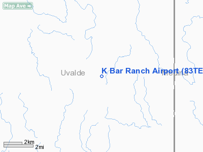
| Longitude/Latitude: | 099-29-38.1660W/29-29-48.8310N
-99.493935/29.496898 (Estimated) |
| Elevation: | 1208 ft / 368.20 m (Estimated) |
| Land: | 0 acres |
| From nearest city: | 10 nautical miles N of Sabinal, TX |
| Location: | Uvalde County, TX |
| Magnetic Variation: | 08E (1985) |
Owner & Manager
| Ownership: | Privately owned |
| Owner: | Mary Kay Kindred |
| Address: | 3019 Colony
San Antonio, TX 78230 |
| Address: |
|
| Phone number: | 512-966-3514
OR 512-696-5470. |
Airport Operations and Facilities
| Airport Use: | Private |
| Wind indicator: | No |
| Segmented Circle: | No |
| Control Tower: | No |
| Landing fee charge: | No |
| Sectional chart: | San Antonio |
| Region: | ASW - Southwest |
| Boundary ARTCC: | ZHU - Houston |
| Tie-in FSS: | SJT - San Angelo |
| FSS on Airport: | No |
| FSS Toll Free: | 1-800-WX-BRIEF |
Airport Services
| Airframe Repair: | NONE |
| Power Plant Repair: | NONE |
Runway Information
Runway 15/33
| Dimension: | 4100 x 150 ft / 1249.7 x 45.7 m |
| Surface: | DIRT, |
| Edge Lights: | Low |
| |
Runway 15 |
Runway 33 |
| Traffic Pattern: | Left | Left |
|
Radio Navigation Aids
| ID |
Type |
Name |
Ch |
Freq |
Var |
Dist |
| HMA | NDB | Hondo | | 329.00 | 08E | 18.4 nm |
| UVA | NDB | Uvalde | | 281.00 | 07E | 22.7 nm |
| CVB | NDB | Castroville | | 338.00 | 08E | 35.0 nm |
| ER | NDB | Shein | | 263.00 | 08E | 35.7 nm |
| HHH | NDB | Devine | | 359.00 | 07E | 36.2 nm |
| LKX | NDB | La Pryor | | 223.00 | 09E | 39.0 nm |
| CPZ | NDB | Chaparrosa Ranch | | 385.00 | 10E | 44.3 nm |
| KSY | TACAN | Kelly | 057X | | 07E | 48.2 nm |
| HDO | VOR/DME | Hondo | 31X | 109.40 | 08E | 18.8 nm |
| CSI | VORTAC | Center Point | 122X | 117.50 | 08E | 29.4 nm |
Remarks
Images and information placed above are from
http://www.airport-data.com/airport/83TE/
We thank them for the data!
| General Info
|
| Country |
United States
|
| State |
TEXAS
|
| FAA ID |
83TE
|
| Latitude |
29-29-48.831N
|
| Longitude |
099-29-38.166W
|
| Elevation |
1208 feet
|
| Near City |
SABINAL
|
We don't guarantee the information is fresh and accurate. The data may
be wrong or outdated.
For more up-to-date information please refer to other sources.
|
|


