 |
|
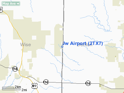
Location & QuickFacts
| FAA Information Effective: | 2008-09-25 |
| Airport Identifier: | 2TX7 |
| Airport Status: | Operational |
| Longitude/Latitude: | 097-23-46.0730W/33-05-40.4380N
-97.396131/33.094566 (Estimated) |
| Elevation: | 875 ft / 266.70 m (Estimated) |
| Land: | 0 acres |
| From nearest city: | 5 nautical miles W of Justin, TX |
| Location: | Wise County, TX |
| Magnetic Variation: | 07E (1985) |
Owner & Manager
| Ownership: | Privately owned |
| Owner: | Joe Max Wilson |
| Address: | Box 32(a) Hwy 407
Rhome, TX 76078 |
| Phone number: | 817-636-2616 |
| Manager: | Joe Max Wilson |
| Address: | Box 32(a) Hwy 407
Rhome, TX 76078 |
| Phone number: | 817-636-2616 |
Airport Operations and Facilities
| Airport Use: | Private
PERSONAL USE. |
| Wind indicator: | Yes |
| Segmented Circle: | Yes |
| Control Tower: | No |
| Sectional chart: | Dallas-ft Worth |
| Region: | ASW - Southwest |
| Boundary ARTCC: | ZFW - Fort Worth |
| Tie-in FSS: | FTW - Fort Worth |
| FSS on Airport: | No |
| FSS Phone: | 817-541-3474 |
| FSS Toll Free: | 1-800-WX-BRIEF |
Runway Information
Runway 17/35
| Dimension: | 2300 x 50 ft / 701.0 x 15.2 m |
| Surface: | TURF, |
| |
Runway 17 |
Runway 35 |
| Traffic Pattern: | Right | Left |
| Obstruction: | 30 ft plines, 100.0 ft from runway | |
|
Radio Navigation Aids
| ID |
Type |
Name |
Ch |
Freq |
Var |
Dist |
| GMZ | NDB | Grindstone Mountain | | 356.00 | 07E | 36.1 nm |
| RBD | NDB | Redbird | | 287.00 | 06E | 36.5 nm |
| XQH | NDB | Cedar Hill | | 353.00 | 08E | 36.9 nm |
| MWL | NDB | Mineral Wells | | 266.00 | 06E | 38.2 nm |
| GLE | NDB | Gainesville | | 330.00 | 06E | 38.8 nm |
| LNC | NDB | Lancaster | | 239.00 | 06E | 46.1 nm |
| PQF | NDB | Mesquite | | 248.00 | 06E | 47.0 nm |
| NFW | TACAN | Nas Jrb Fort Worth | 024X | | 07E | 19.5 nm |
| TTT | VOR/DME | Maverick | 078X | 113.10 | 06E | 22.5 nm |
| CVE | VOR/DME | Cowboy | 109X | 116.20 | 06E | 27.7 nm |
| FUZ | VORTAC | Ranger | 104X | 115.70 | 06E | 16.5 nm |
| UKW | VORTAC | Bowie | 071X | 112.40 | 06E | 34.1 nm |
| MQP | VORTAC | Millsap | 124X | 117.70 | 09E | 37.6 nm |
| FTW | VOT | Fort Worth Meacham | | 108.20 | | 16.8 nm |
| DAL | VOT | Dallas Love Field | | 113.30 | | 31.2 nm |
Remarks
- PRVDD ALL TRAFFIC OPNS ARE CONDUCTED IN ACCORDANCE WITH LETTER OF AGREEMENT DATED JUNE 14, 1989.
Images and information placed above are from
http://www.airport-data.com/airport/2TX7/
We thank them for the data!
| General Info
|
| Country |
United States
|
| State |
TEXAS
|
| FAA ID |
2TX7
|
| Latitude |
33-05-40.438N
|
| Longitude |
097-23-46.073W
|
| Elevation |
875 feet
|
| Near City |
JUSTIN
|
We don't guarantee the information is fresh and accurate. The data may
be wrong or outdated.
For more up-to-date information please refer to other sources.
|
|


