 |
|
Location & QuickFacts
| FAA Information Effective: | 2008-09-25 |
| Airport Identifier: | 90TS |
| Airport Status: | Operational |
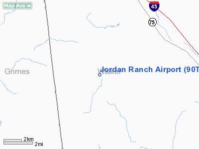
| Longitude/Latitude: | 095-47-50.0000W/30-46-45.0000N
-95.797222/30.779167 (Estimated) |
| Elevation: | 265 ft / 80.77 m (Estimated) |
| Land: | 1500 acres |
| From nearest city: | 8 nautical miles E of Bedias, TX |
| Location: | Walker County, TX |
| Magnetic Variation: | 05E (2000) |
Owner & Manager
| Ownership: | Privately owned |
| Owner: | W. H. Jordan |
| Address: | 1697 Fm 1696 W
Huntsville, TX 77340 |
| Phone number: | 936-295-1844 |
| Manager: | W. H. Jordan |
| Address: | 1697 Fm 1696 W
Huntsville, TX 77340 |
| Phone number: | 936-295-1844 |
Airport Operations and Facilities
| Airport Use: | Private |
| Wind indicator: | Yes |
| Segmented Circle: | No |
| Control Tower: | No |
| Sectional chart: | Houston |
| Region: | ASW - Southwest |
| Boundary ARTCC: | ZHU - Houston |
| Tie-in FSS: | CXO - Montgomery County |
| FSS Toll Free: | 1-800-WX-BRIEF |
Runway Information
Runway 17/35
| Dimension: | 1500 x 60 ft / 457.2 x 18.3 m |
| Surface: | DIRT, |
| |
Runway 17 |
Runway 35 |
| Traffic Pattern: | Left | Left |
| Obstruction: | 50 ft tree | |
|
Radio Navigation Aids
| ID |
Type |
Name |
Ch |
Freq |
Var |
Dist |
| UTS | NDB | Huntsville | | 308.00 | 06E | 10.9 nm |
| DWH | NDB | David Hooks | | 521.00 | 05E | 41.1 nm |
| BNH | NDB | Brenham | | 362.00 | 06E | 44.8 nm |
| LOA | VORTAC | Leona | 045X | 110.80 | 08E | 22.5 nm |
| TNV | VORTAC | Navasota | 106X | 115.90 | 08E | 32.4 nm |
| CLL | VORTAC | College Station | 080X | 113.30 | 08E | 33.9 nm |
Images and information placed above are from
http://www.airport-data.com/airport/90TS/
We thank them for the data!
|
|


