 |
|
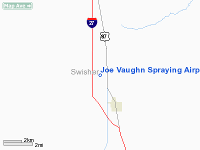
Joe Vaughn Spraying Airport |
Location & QuickFacts
| FAA Information Effective: | 2008-09-25 |
| Airport Identifier: | 29F |
| Airport Status: | Operational |
| Longitude/Latitude: | 101-46-01.6510W/34-23-45.2330N
-101.767125/34.395898 (Estimated) |
| Elevation: | 3500 ft / 1066.80 m (Estimated) |
| Land: | 30 acres |
| From nearest city: | 1 nautical miles N of Kress, TX |
| Location: | Swisher County, TX |
| Magnetic Variation: | 09E (1985) |
Owner & Manager
| Ownership: | Privately owned |
| Owner: | Joe Vaughn Spraying, Inc. |
| Address: | 629 Us Hwy 87
Kress, TX 79052 |
| Phone number: | 806-684-2732 |
| Manager: | John Vaughn |
| Address: | 629 Us Hwy 87
Kress, TX 79052 |
| Phone number: | 806-684-2732 |
Airport Operations and Facilities
| Airport Use: | Open to public |
| Wind indicator: | Yes |
| Segmented Circle: | No |
| Control Tower: | No |
| Landing fee charge: | No |
| Sectional chart: | Dallas-ft Worth |
| Region: | ASW - Southwest |
| Boundary ARTCC: | ZFW - Fort Worth |
| Tie-in FSS: | FTW - Fort Worth |
| FSS on Airport: | No |
| FSS Phone: | 817-541-3474 |
| FSS Toll Free: | 1-800-WX-BRIEF |
| NOTAMs Facility: | FTW (NOTAM-d service avaliable) |
Airport Communications
| CTAF: | 122.700 |
| Unicom: | 122.700 |
Airport Services
| Fuel available: | 100LLA |
| Airframe Repair: | MAJOR |
| Power Plant Repair: | MAJOR |
Runway Information
Runway 17/35
| Dimension: | 3900 x 60 ft / 1188.7 x 18.3 m |
| Surface: | DIRT, Fair Condition |
| |
Runway 17 |
Runway 35 |
| Traffic Pattern: | Left | Left |
| Obstruction: | 15 ft road, 16.0 ft from runway, 1:1 slope to clear | 29 ft tree, 144.0 ft from runway, 85 ft right of centerline, 4:1 slope to clear |
|
Radio Navigation Aids
| ID |
Type |
Name |
Ch |
Freq |
Var |
Dist |
| HRX | NDB | Hereford | | 341.00 | 09E | 39.1 nm |
| LIU | NDB | Littlefield | | 212.00 | 10E | 42.1 nm |
| AM | NDB | Pande | | 251.00 | 09E | 45.2 nm |
| PVW | VOR/DME | Plainview | 076X | 112.90 | 11E | 18.7 nm |
| LBB | VORTAC | Lubbock | 029X | 109.20 | 11E | 42.2 nm |
Remarks
- RY 17 +30 FT PLINE 46 FT FM THR 77 FT RIGHT CNTRLN.
- 25 FT BLDGS 53 FT RIGHT OF CENTERLINE AT RY 35 END.
- PROVIDED THR RWY 17 IS DSPLCD TO PROVIDE REQUIRED CLEARANCE OVER COUNTY ROAD/300' FOR THE DIRT RWY.
Images and information placed above are from
http://www.airport-data.com/airport/29F/
We thank them for the data!
| General Info
|
| Country |
United States
|
| State |
TEXAS
|
| FAA ID |
29F
|
| Latitude |
34-23-45.233N
|
| Longitude |
101-46-01.651W
|
| Elevation |
3500 feet
|
| Near City |
KRESS
|
We don't guarantee the information is fresh and accurate. The data may
be wrong or outdated.
For more up-to-date information please refer to other sources.
|
|


