 |
|
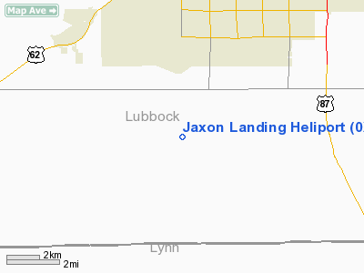
Location & QuickFacts
| FAA Information Effective: | 2008-09-25 |
| Airport Identifier: | 0XA6 |
| Airport Status: | Operational |
| Longitude/Latitude: | 101-56-20.4000W/33-27-00.0000N
-101.939000/33.450000 (Estimated) |
| Elevation: | 3270 ft / 996.70 m (Estimated) |
| Land: | 6 acres |
| From nearest city: | 7 nautical miles SW of Lubbock, TX |
| Location: | Lubbock County, TX |
| Magnetic Variation: | () |
Owner & Manager
| Ownership: | Privately owned |
| Owner: | Galli Davis |
| Address: | 4502 81st St
Lubbock, TX 79424 |
| Phone number: | 806-438-0274 |
| Manager: | Galli Davis |
| Address: | 15105 Frankford Ave
Lubbock, TX 79424 |
| Phone number: | 806-438-0274 |
Airport Operations and Facilities
| Airport Use: | Private |
| Wind indicator: | Yes |
| Control Tower: | No |
| Sectional chart: | Dallas-ft Worth |
| Region: | ASW - Southwest |
| Boundary ARTCC: | ZFW - Fort Worth |
| Tie-in FSS: | FTW - Fort Worth |
| FSS Phone: | 817-541-3474 |
| FSS Toll Free: | 1-800-WX-BRIEF |
Runway Information
Helipad H1
| Dimension: | 50 x 50 ft / 15.2 x 15.2 m |
| Surface: | TURF, |
| |
Runway H1 |
Runway |
| Traffic Pattern: | Left | Left |
|
Radio Navigation Aids
| ID |
Type |
Name |
Ch |
Freq |
Var |
Dist |
| BFE | NDB | Brownfield | | 311.00 | 09E | 20.6 nm |
| LLN | NDB | Levelland | | 266.00 | 09E | 22.8 nm |
| LIU | NDB | Littlefield | | 212.00 | 10E | 36.0 nm |
| CZX | NDB | Crosbyton | | 332.00 | 09E | 36.6 nm |
| LSA | NDB | Lamesa | | 338.00 | 09E | 41.6 nm |
| PVW | VOR/DME | Plainview | 076X | 112.90 | 11E | 39.0 nm |
| LBB | VORTAC | Lubbock | 029X | 109.20 | 11E | 15.4 nm |
Images and information placed above are from
http://www.airport-data.com/airport/0XA6/
We thank them for the data!
|
|


