 |
|
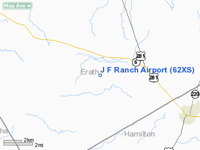
Location & QuickFacts
| FAA Information Effective: | 2008-09-25 |
| Airport Identifier: | 62XS |
| Airport Status: | Operational |
| Longitude/Latitude: | 098-08-01.1340W/32-01-20.5250N
-98.133648/32.022368 (Estimated) |
| Elevation: | 1220 ft / 371.86 m (Estimated) |
| Land: | 0 acres |
| From nearest city: | 2 nautical miles SW of Clairette, TX |
| Location: | Erath County, TX |
| Magnetic Variation: | 07E (1985) |
Owner & Manager
| Ownership: | Privately owned |
| Owner: | Jack Farrar |
| Address: | Rt 5 Box 174a
Dublin, TX 76446 |
| Phone number: | 817-796-2222 |
| Manager: | Jack Farrar |
| Address: | Rt 5 Box 174a
Dublin, TX 76446 |
| Phone number: | 817-796-2222 |
Airport Operations and Facilities
| Airport Use: | Private |
| Wind indicator: | Yes |
| Segmented Circle: | No |
| Control Tower: | No |
| Lighting Schedule: | PHONE REQ
FOR MIRL RY 16/34 CALL 817-796-2222. |
| Landing fee charge: | No |
| Sectional chart: | Dallas-ft Worth |
| Region: | ASW - Southwest |
| Boundary ARTCC: | ZFW - Fort Worth |
| Tie-in FSS: | FTW - Fort Worth |
| FSS on Airport: | No |
| FSS Phone: | 817-541-3474 |
| FSS Toll Free: | 1-800-WX-BRIEF |
Runway Information
Runway 16/34
| Dimension: | 2400 x 60 ft / 731.5 x 18.3 m |
| Surface: | TURF, |
| Edge Lights: | Medium
MIRL LCTD ON NORTH END 1400' ONLY. |
| |
Runway 16 |
Runway 34 |
| Traffic Pattern: | Left | Left |
|
Radio Navigation Aids
| ID |
Type |
Name |
Ch |
Freq |
Var |
Dist |
| MNZ | NDB | Hamilton | | 251.00 | 07E | 24.2 nm |
| OIP | NDB | Old Rip | | 410.00 | 07E | 41.2 nm |
| MWL | NDB | Mineral Wells | | 266.00 | 06E | 46.0 nm |
| BWD | VOR/DME | Brownwood | 023X | 108.60 | 08E | 42.7 nm |
| JEN | VORTAC | Glen Rose | 097X | 115.00 | 06E | 15.4 nm |
| MQP | VORTAC | Millsap | 124X | 117.70 | 09E | 42.9 nm |
| ACT | VORTAC | Waco | 100X | 115.30 | 09E | 49.2 nm |
Remarks
- CATTLE AND/OR DEER MAY BE ON RY; RY NOT FENCED.
Images and information placed above are from
http://www.airport-data.com/airport/62XS/
We thank them for the data!
| General Info
|
| Country |
United States
|
| State |
TEXAS
|
| FAA ID |
62XS
|
| Latitude |
32-01-20.525N
|
| Longitude |
098-08-01.134W
|
| Elevation |
1220 feet
|
| Near City |
CLAIRETTE
|
We don't guarantee the information is fresh and accurate. The data may
be wrong or outdated.
For more up-to-date information please refer to other sources.
|
|


