 |
|
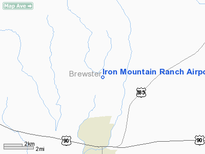
Iron Mountain Ranch Airport |
Location & QuickFacts
| FAA Information Effective: | 2008-09-25 |
| Airport Identifier: | 5TE5 |
| Airport Status: | Operational |
| Longitude/Latitude: | 103-14-11.6280W/30-16-25.5980N
-103.236563/30.273777 (Estimated) |
| Elevation: | 4313 ft / 1314.60 m (Surveyed) |
| Land: | 0 acres |
| From nearest city: | 3 nautical miles N of Marathon, TX |
| Location: | Brewster County, TX |
| Magnetic Variation: | 09E (1985) |
Owner & Manager
| Ownership: | Privately owned |
| Owner: | William B Blakemore Ii |
| Address: | Po Box 4605
Midland, TX 79701 |
| Address: |
|
Airport Operations and Facilities
| Airport Use: | Private |
| Wind indicator: | Yes |
| Segmented Circle: | No |
| Control Tower: | No |
| Lighting Schedule: | PHONE REQ
FOR RWY LGTS AND ROTG BCN OPERS ON PRIOR REQUEST |
| Beacon Color: | Clear (unlighted land airport) |
| Landing fee charge: | No |
| Sectional chart: | El Paso |
| Region: | ASW - Southwest |
| Boundary ARTCC: | ZAB - Albuquerque |
| Tie-in FSS: | SJT - San Angelo |
| FSS on Airport: | No |
| FSS Toll Free: | 1-800-WX-BRIEF |
Airport Services
| Airframe Repair: | NONE |
| Power Plant Repair: | NONE |
Runway Information
Runway 16/34
| Dimension: | 4000 x 30 ft / 1219.2 x 9.1 m |
| Surface: | ASPH, |
| Edge Lights: | Low |
| |
Runway 16 |
Runway 34 |
| Traffic Pattern: | Left | Left |
|
Radio Navigation Aids
| ID |
Type |
Name |
Ch |
Freq |
Var |
Dist |
| IMP | NDB | Marathon | | 388.00 | 10E | 0.6 nm |
| BWR | NDB | Brewster County | | 412.00 | 09E | 24.0 nm |
| MRF | VOR/DME | Marfa | 106X | 115.90 | 11E | 37.3 nm |
| FST | VORTAC | Fort Stockton | 116X | 116.90 | 11E | 42.9 nm |
Images and information placed above are from
http://www.airport-data.com/airport/5TE5/
We thank them for the data!
| General Info
|
| Country |
United States
|
| State |
TEXAS
|
| FAA ID |
5TE5
|
| Latitude |
30-16-25.598N
|
| Longitude |
103-14-11.628W
|
| Elevation |
4313 feet
|
| Near City |
MARATHON
|
We don't guarantee the information is fresh and accurate. The data may
be wrong or outdated.
For more up-to-date information please refer to other sources.
|
|


