 |
|
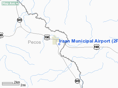
Location & QuickFacts
| FAA Information Effective: | 2008-09-25 |
| Airport Identifier: | 2F0 |
| Airport Status: | Operational |
| Longitude/Latitude: | 101-53-31.4620W/30-54-20.5730N
-101.892073/30.905715 (Estimated) |
| Elevation: | 2200 ft / 670.56 m (Estimated) |
| Land: | 83 acres |
| From nearest city: | 1 nautical miles SE of Iraan, TX |
| Location: | Pecos County, TX |
| Magnetic Variation: | 09E (1985) |
Owner & Manager
| Ownership: | Publicly owned |
| Owner: | Pecos Co. |
| Address: | Courthouse
Fort Stockton, TX 79735 |
| Phone number: | 432-336-2792 |
| Manager: | Jay Kent
COUNTY COMMISSIONER. |
| Address: | Box 456
Iraan, TX 79744 |
| Phone number: | 432-639-2841 |
Airport Operations and Facilities
| Airport Use: | Open to public |
| Wind indicator: | Yes |
| Segmented Circle: | Yes |
| Control Tower: | No |
| Lighting Schedule: | DUSK-DAWN |
| Beacon Color: | Clear-Green (lighted land airport) |
| Landing fee charge: | No |
| Sectional chart: | San Antonio |
| Region: | ASW - Southwest |
| Boundary ARTCC: | ZHU - Houston |
| Tie-in FSS: | SJT - San Angelo |
| FSS on Airport: | No |
| FSS Toll Free: | 1-800-WX-BRIEF |
| NOTAMs Facility: | SJT (NOTAM-d service avaliable) |
Airport Communications
Airport Services
| Fuel available: | 100LL |
| Airframe Repair: | NONE |
| Power Plant Repair: | NONE |
| Bottled Oxygen: | NONE |
| Bulk Oxygen: | NONE |
Runway Information
Runway 07/25
| Dimension: | 2755 x 50 ft / 839.7 x 15.2 m |
| Surface: | ASPH, Poor Condition
NUMEROUS CRACKS AND LOOSE GRAVEL. |
| Weight Limit: | Single wheel: 12500 lbs. |
| |
Runway 07 |
Runway 25 |
| Traffic Pattern: | Left | Left |
| Markings: | Basic, Fair Condition | Basic, Fair Condition |
| Obstruction: | 10 ft brush, 200.0 ft from runway
+4 FT BRUSH 65 FT FM THLD ACROSS APCH; +15 FT WIND SOCK POLE 90 FT FM THLD 100 FT L OF CNTRLN. | 15 ft pline, 420.0 ft from runway, 14:1 slope to clear
+4 FT FENCE 75 FT LEFT & RIGHT OF CNTRLN AT THLD; +4 FT FENCE 35 FT FM THLD ON CNTRLN; 8-15 FT BRUSH 35-200 FT FM THLD ACROSS APCH. |
|
Runway 14/32
| Dimension: | 4085 x 60 ft / 1245.1 x 18.3 m |
| Surface: | ASPH, Good Condition
NUMEROUS CRACKS AND LOOSE GRAVEL. |
| Weight Limit: | Single wheel: 12500 lbs. |
| Edge Lights: | Non-standard lighting system
NSTD LIRL. RY 14 HAS NO DSPLCD THLD LGTS; RY 32 HAS SINGLE GREEN DSPLCD THLD LGT. |
| |
Runway 14 |
Runway 32 |
| Traffic Pattern: | Left | Left |
| Markings: | Basic, Good Condition | Basic, Good Condition |
| Displaced threshold: | 500.00 ft
& 32 THRS DSPLCD DAY OPNS ONLY. | 490.00 ft |
| Obstruction: | 35 ft pline, 200.0 ft from runway, 125 ft left of centerline
APCH SLOPE 0:1 TO DSPLCD THLD FM +15 FT BRUSH AT DSPLCD THLD 95 FT LEFT CNTRLN.
+4 FT FENCE 80 FT FM THLD ON CNTRLN. | , 50:1 slope to clear
APCH SLOPE 0:1 TO DSPLCD THLD TO +4 FT FENCE AT DSPLCD THLD 120 FT L CNTRLN & 100 FT R CNTRLN.
+3 FT BRUSH 70 FT FM THLD ACROSS APCH; SEVERE SLOPE SOUTH END OF RY. |
|
Radio Navigation Aids
| ID |
Type |
Name |
Ch |
Freq |
Var |
Dist |
Remarks
- WILDLIFE ON AND IN VICINITY OF AIRPORT.
- RISING TERRAIN SOUTHWEST AND WEST OF AIRPORT.
Images and information placed above are from
http://www.airport-data.com/airport/2F0/
We thank them for the data!
| General Info
|
| Country |
United States
|
| State |
TEXAS
|
| FAA ID |
2F0
|
| Latitude |
30-54-20.573N
|
| Longitude |
101-53-31.462W
|
| Elevation |
2200 feet
|
| Near City |
IRAAN
|
We don't guarantee the information is fresh and accurate. The data may
be wrong or outdated.
For more up-to-date information please refer to other sources.
|
|


