 |
|
Location & QuickFacts
| FAA Information Effective: | 2008-09-25 |
| Airport Identifier: | 2XS2 |
| Airport Status: | Operational |
| Longitude/Latitude: | 100-09-44.3000W/28-15-46.2500N
-100.162306/28.262847 (Estimated) |
| Elevation: | 750 ft / 228.60 m (Estimated) |
| Land: | 0 acres |
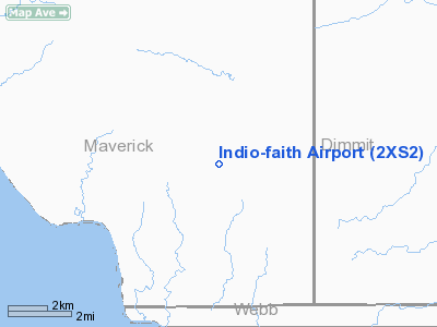
| From nearest city: | 24 nautical miles SW of Carrizo Springs, TX |
| Location: | Maverick County, TX |
| Magnetic Variation: | 07E (2000) |
Owner & Manager
| Ownership: | Privately owned |
| Owner: | Walter Umphrey |
| Address: | Po Box 4905
Beaumont, TX 77704 |
| Phone number: | 409-838-8848 |
| Manager: | James Overstreet |
| Address: | Route 4 Box 78
Beaumont, TX 77705 |
| Phone number: | 409-722-9655 |
Airport Operations and Facilities
| Airport Use: | Private |
| Wind indicator: | Yes |
| Segmented Circle: | No |
| Control Tower: | No |
| Sectional chart: | San Antonio |
| Region: | ASW - Southwest |
| Boundary ARTCC: | ZHU - Houston |
| Tie-in FSS: | SJT - San Angelo |
| FSS on Airport: | No |
| FSS Toll Free: | 1-800-WX-BRIEF |
Runway Information
Runway 15/33
| Dimension: | 5000 x 50 ft / 1524.0 x 15.2 m |
| Surface: | ASPH, |
| |
Runway 15 |
Runway 33 |
| Traffic Pattern: | Left | Left |
| Obstruction: | | 31 ft bldg, 1320.0 ft from runway |
|
Radio Navigation Aids
| ID |
Type |
Name |
Ch |
Freq |
Var |
Dist |
| DMD | NDB | Dimmit County | | 343.00 | 07E | 23.6 nm |
| CPZ | NDB | Chaparrosa Ranch | | 385.00 | 10E | 39.8 nm |
| LKX | NDB | La Pryor | | 223.00 | 09E | 43.3 nm |
Images and information placed above are from
http://www.airport-data.com/airport/2XS2/
We thank them for the data!
| General Info
|
| Country |
United States
|
| State |
TEXAS
|
| FAA ID |
2XS2
|
| Latitude |
28-15-46.250N
|
| Longitude |
100-09-44.300W
|
| Elevation |
750 feet
|
| Near City |
CARRIZO SPRINGS
|
We don't guarantee the information is fresh and accurate. The data may
be wrong or outdated.
For more up-to-date information please refer to other sources.
|
|


