 |
|
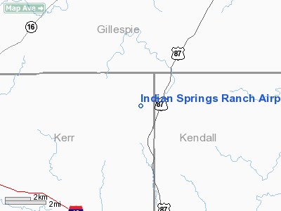
Indian Springs Ranch Airport |
Location & QuickFacts
| FAA Information Effective: | 2008-09-25 |
| Airport Identifier: | 7XS7 |
| Airport Status: | Operational |
| Longitude/Latitude: | 098-55-52.0000W/30-06-53.0000N
-98.931111/30.114722 (Estimated) |
| Elevation: | 2030 ft / 618.74 m (Estimated) |
| Land: | 11 acres |
| From nearest city: | 9 nautical miles S of Fredericksburg, TX |
| Location: | Kerr County, TX |
| Magnetic Variation: | 07E (1995) |
Owner & Manager
| Ownership: | Privately owned |
| Owner: | Ray H Tolson |
| Address: | Hc12 Box 64r
Fredericksburg, TX 78624 |
| Phone number: | 830-995-3593 |
| Manager: | Ray H Tolson |
| Address: | Hc12 Box 64r
Fredericksburg, TX 78624 |
| Phone number: | 830-995-3593 |
Airport Operations and Facilities
| Airport Use: | Private |
| Wind indicator: | Yes |
| Segmented Circle: | No |
| Control Tower: | No |
| Sectional chart: | San Antonio |
| Region: | ASW - Southwest |
| Boundary ARTCC: | ZHU - Houston |
| Tie-in FSS: | SJT - San Angelo |
| FSS on Airport: | No |
| FSS Toll Free: | 1-800-WX-BRIEF |
Runway Information
Runway 15/33
| Dimension: | 3300 x 40 ft / 1005.8 x 12.2 m |
| Surface: | ASPH, |
| |
Runway 15 |
Runway 33 |
| Traffic Pattern: | Left | Left |
| Obstruction: | 30 ft trees, 100.0 ft from runway | 25 ft trees, 30.0 ft from runway |
|
Radio Navigation Aids
| ID |
Type |
Name |
Ch |
Freq |
Var |
Dist |
| ER | NDB | Shein | | 263.00 | 08E | 12.7 nm |
| MFS | NDB | Horseshoe Bay Resort | | 403.00 | 07E | 38.6 nm |
| HMA | NDB | Hondo | | 329.00 | 08E | 46.3 nm |
| CVB | NDB | Castroville | | 338.00 | 08E | 46.4 nm |
| KSY | TACAN | Kelly | 057X | | 07E | 47.1 nm |
| DHK | TACAN | Randolph | 036X | | 09E | 49.0 nm |
| HDO | VOR/DME | Hondo | 31X | 109.40 | 08E | 47.8 nm |
| STV | VORTAC | Stonewall | 085X | 113.80 | 08E | 13.0 nm |
| CSI | VORTAC | Center Point | 122X | 117.50 | 08E | 18.7 nm |
| SAT | VORTAC | San Antonio | 115X | 116.80 | 08E | 37.4 nm |
| LLO | VORTAC | Llano | 019X | 108.20 | 08E | 41.6 nm |
| RND | VORTAC | Randolph | 70X | 112.30 | 09E | 49.2 nm |
| SAT | VOT | San Antonio Intl | | 110.40 | | 42.4 nm |
Images and information placed above are from
http://www.airport-data.com/airport/7XS7/
We thank them for the data!
| General Info
|
| Country |
United States
|
| State |
TEXAS
|
| FAA ID |
7XS7
|
| Latitude |
30-06-53.000N
|
| Longitude |
098-55-52.000W
|
| Elevation |
2030 feet
|
| Near City |
FREDERICKSBURG
|
We don't guarantee the information is fresh and accurate. The data may
be wrong or outdated.
For more up-to-date information please refer to other sources.
|
|


