 |
|
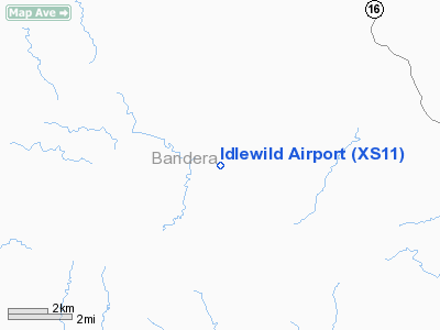
Location & QuickFacts
| FAA Information Effective: | 2008-09-25 |
| Airport Identifier: | XS11 |
| Airport Status: | Operational |
| Longitude/Latitude: | 099-21-33.1580W/29-46-35.7990N
-99.359211/29.776611 (Estimated) |
| Elevation: | 1660 ft / 505.97 m (Surveyed) |
| Land: | 0 acres |
| From nearest city: | 6 nautical miles W of Medina, TX |
| Location: | Bandera County, TX |
| Magnetic Variation: | 08E (1985) |
Owner & Manager
| Ownership: | Privately owned |
| Owner: | John M Barnett |
| Address: | P O Box 1104
Ft Davis, TX 79734 |
| Phone number: | 512-472-4888 |
| Manager: | Chris S Barnett |
| Address: | P O Box 1104
Ft Davis, TX 79734 |
| Phone number: | 512-472-4888 |
Airport Operations and Facilities
| Airport Use: | Private |
| Wind indicator: | Yes |
| Segmented Circle: | No |
| Control Tower: | No |
| Landing fee charge: | No |
| Sectional chart: | San Antonio |
| Region: | ASW - Southwest |
| Boundary ARTCC: | ZHU - Houston |
| Tie-in FSS: | SJT - San Angelo |
| FSS on Airport: | No |
| FSS Toll Free: | 1-800-WX-BRIEF |
Airport Services
| Airframe Repair: | NONE |
| Power Plant Repair: | NONE |
Runway Information
Runway 11/29
| Dimension: | 3200 x 60 ft / 975.4 x 18.3 m |
| Surface: | ASPH, |
| |
Runway 11 |
Runway 29 |
| Traffic Pattern: | Left | Left |
|
Radio Navigation Aids
| ID |
Type |
Name |
Ch |
Freq |
Var |
Dist |
| ER | NDB | Shein | | 263.00 | 08E | 20.0 nm |
| HMA | NDB | Hondo | | 329.00 | 08E | 26.1 nm |
| CVB | NDB | Castroville | | 338.00 | 08E | 37.2 nm |
| UVA | NDB | Uvalde | | 281.00 | 07E | 40.8 nm |
| HHH | NDB | Devine | | 359.00 | 07E | 44.2 nm |
| KSY | TACAN | Kelly | 057X | | 07E | 46.8 nm |
| HDO | VOR/DME | Hondo | 31X | 109.40 | 08E | 27.4 nm |
| CSI | VORTAC | Center Point | 122X | 117.50 | 08E | 11.6 nm |
| STV | VORTAC | Stonewall | 085X | 113.80 | 08E | 42.7 nm |
| SAT | VORTAC | San Antonio | 115X | 116.80 | 08E | 47.5 nm |
| SAT | VOT | San Antonio Intl | | 110.40 | | 48.7 nm |
Images and information placed above are from
http://www.airport-data.com/airport/XS11/
We thank them for the data!
| General Info
|
| Country |
United States
|
| State |
TEXAS
|
| FAA ID |
XS11
|
| Latitude |
29-46-35.799N
|
| Longitude |
099-21-33.158W
|
| Elevation |
1660 feet
|
| Near City |
MEDINA
|
We don't guarantee the information is fresh and accurate. The data may
be wrong or outdated.
For more up-to-date information please refer to other sources.
|
|


