 |
|
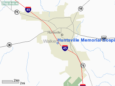
Huntsville Memorial Hospital Heliport |
Location & QuickFacts
| FAA Information Effective: | 2008-09-25 |
| Airport Identifier: | TE03 |
| Airport Status: | Operational |
| Longitude/Latitude: | 095-33-28.7970W/30-41-50.6980N
-95.557999/30.697416 (Estimated) |
| Elevation: | 436 ft / 132.89 m (Estimated) |
| Land: | 12 acres |
| From nearest city: | 0 nautical miles W of Huntsville, TX |
| Location: | Walker County, TX |
| Magnetic Variation: | 06E (1985) |
Owner & Manager
| Ownership: | Publicly owned |
| Owner: | Huntsville Memorial Hospital |
| Address: | 3000 I-45, Box 479
Huntsville, TX 77340 |
| Phone number: | 409-291-3411 |
| Manager: | Administrator |
| Address: | 3000 I-45, Box 479
Huntsville, TX 77340 |
| Phone number: | 409-291-3411 |
Airport Operations and Facilities
| Airport Use: | Private
MEDICAL |
| Wind indicator: | Yes |
| Segmented Circle: | No |
| Control Tower: | No |
| Lighting Schedule: | DUSK-DAWN |
| Beacon Color: | Clear-Green-Yellow (heliport) |
| Sectional chart: | Houston |
| Region: | ASW - Southwest |
| Boundary ARTCC: | ZHU - Houston |
| Tie-in FSS: | CXO - Montgomery County |
| FSS Toll Free: | 1-800-WX-BRIEF
FOR FP FILING CALL CXO FSS 1-800-833-5602. |
Runway Information
Helipad H1
| Dimension: | 35 x 35 ft / 10.7 x 10.7 m |
| Surface: | CONC, |
| |
Runway H1 |
Runway |
| Traffic Pattern: | Left | Left |
|
Radio Navigation Aids
| ID |
Type |
Name |
Ch |
Freq |
Var |
Dist |
| UTS | NDB | Huntsville | | 308.00 | 06E | 3.1 nm |
| DWH | NDB | David Hooks | | 521.00 | 05E | 34.4 nm |
| BVP | NDB | Nixin | | 326.00 | 05E | 45.9 nm |
| EYQ | NDB | Weiser | | 286.00 | 06E | 46.1 nm |
| LOA | VORTAC | Leona | 045X | 110.80 | 08E | 33.2 nm |
| TNV | VORTAC | Navasota | 106X | 115.90 | 08E | 35.7 nm |
| CLL | VORTAC | College Station | 080X | 113.30 | 08E | 45.0 nm |
| IAH | VORTAC | Humble | 113X | 116.60 | 05E | 45.9 nm |
Remarks
- PRVDD INGRESS/EGRESS ROUTES ARE CONDUCTED FM/TO SOUTHEAST AND NORTHWEST ONLY.
Images and information placed above are from
http://www.airport-data.com/airport/TE03/
We thank them for the data!
| General Info
|
| Country |
United States
|
| State |
TEXAS
|
| FAA ID |
TE03
|
| Latitude |
30-41-50.698N
|
| Longitude |
095-33-28.797W
|
| Elevation |
436 feet
|
| Near City |
HUNTSVILLE
|
We don't guarantee the information is fresh and accurate. The data may
be wrong or outdated.
For more up-to-date information please refer to other sources.
|
|


