 |
|
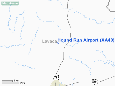
Location & QuickFacts
| FAA Information Effective: | 2008-09-25 |
| Airport Identifier: | XA40 |
| Airport Status: | Operational |
| Longitude/Latitude: | 096-56-12.9300W/29-31-17.5600N
-96.936925/29.521544 (Estimated) |
| Elevation: | 385 ft / 117.35 m (Estimated) |
| Land: | 0 acres |
| From nearest city: | 5 nautical miles N of Hallettsville, TX |
| Location: | Lavaca County, TX |
| Magnetic Variation: | () |
Owner & Manager
| Ownership: | Privately owned |
| Owner: | James L. Frey |
| Address: | 128 Cr 242
Halletsville, TX 77964 |
| Phone number: | 361-798-7137 |
| Manager: | James L. Frey |
| Address: | 128 Cr 242
Hallettsville, TX 77964 |
| Phone number: | 361-798-7137 |
Airport Operations and Facilities
| Airport Use: | Private |
| Wind indicator: | Yes |
| Control Tower: | No |
| Sectional chart: | Houston |
| Region: | ASW - Southwest |
| Boundary ARTCC: | ZHU - Houston |
| Tie-in FSS: | CXO - Montgomery County |
| FSS Toll Free: | 1-800-WX-BRIEF |
Runway Information
Runway 16/34
| Dimension: | 2480 x 75 ft / 755.9 x 22.9 m |
| Surface: | TURF, |
| |
Runway 16 |
Runway 34 |
| Traffic Pattern: | Left | Left |
| Obstruction: | 4 ft fence | 4 ft fence, 0.0 ft from runway |
|
Radio Navigation Aids
| ID |
Type |
Name |
Ch |
Freq |
Var |
Dist |
| OKT | NDB | Yoakum | | 350.00 | 06E | 16.4 nm |
| GYB | NDB | Lee County | | 385.00 | 07E | 39.0 nm |
| ARM | NDB | Wharton | | 245.00 | 06E | 44.1 nm |
| ELA | VOR/DME | Eagle Lake | 111X | 116.40 | 08E | 33.5 nm |
| VCT | VOR/DME | Victoria | 027X | 109.00 | 06E | 37.4 nm |
| IDU | VORTAC | Industry | 039X | 110.20 | 08E | 32.6 nm |
Remarks
Images and information placed above are from
http://www.airport-data.com/airport/XA40/
We thank them for the data!
|
|


