 |
|
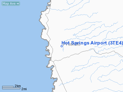
Location & QuickFacts
| FAA Information Effective: | 2008-09-25 |
| Airport Identifier: | 3TE4 |
| Airport Status: | Operational |
| Longitude/Latitude: | 104-39-52.7280W/30-00-31.5850N
-104.664647/30.008774 (Estimated) |
| Elevation: | 3071 ft / 936.04 m (Estimated) |
| Land: | 4 acres |
| From nearest city: | 2 nautical miles NE of Ruidosa, TX |
| Location: | Presidio County, TX |
| Magnetic Variation: | 10E (1985) |
Owner & Manager
| Ownership: | Publicly owned
APT ON STATE OWNED LAND; STATE DOES NOT MAINTAIN APT. |
| Owner: | State Of Texas Glo |
| Address: | 1700n Congress
Austin, TX 78701 |
| Phone number: | 512-463-5010 |
| Address: |
|
Airport Operations and Facilities
| Airport Use: | Private |
| Wind indicator: | No |
| Segmented Circle: | No |
| Control Tower: | No |
| Landing fee charge: | No |
| Sectional chart: | El Paso |
| Region: | ASW - Southwest |
| Boundary ARTCC: | ZAB - Albuquerque |
| Tie-in FSS: | SJT - San Angelo |
| FSS on Airport: | No |
| FSS Toll Free: | 1-800-WX-BRIEF |
Runway Information
Runway 01/19
| Dimension: | 2500 x 75 ft / 762.0 x 22.9 m |
| Surface: | DIRT, Good Condition |
| |
Runway 01 |
Runway 19 |
| Traffic Pattern: | Left | Left |
| Obstruction: | 5 ft brush, 38 ft right of centerline | 10 ft road, 0.0 ft from runway, 65 ft right of centerline |
|
Radio Navigation Aids
| ID |
Type |
Name |
Ch |
Freq |
Var |
Dist |
| MRF | VOR/DME | Marfa | 106X | 115.90 | 11E | 40.8 nm |
Remarks
Images and information placed above are from
http://www.airport-data.com/airport/3TE4/
We thank them for the data!
| General Info
|
| Country |
United States
|
| State |
TEXAS
|
| FAA ID |
3TE4
|
| Latitude |
30-00-31.585N
|
| Longitude |
104-39-52.728W
|
| Elevation |
3071 feet
|
| Near City |
RUIDOSA
|
We don't guarantee the information is fresh and accurate. The data may
be wrong or outdated.
For more up-to-date information please refer to other sources.
|
|


