 |
|
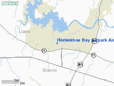
Horseshoe Bay Airpark Airport |
Location & QuickFacts
| FAA Information Effective: | 2008-09-25 |
| Airport Identifier: | 4XS7 |
| Airport Status: | Operational |
| Longitude/Latitude: | 098-21-31.4870W/30-31-37.3860N
-98.358746/30.527052 (Estimated) |
| Elevation: | 1092 ft / 332.84 m (Surveyed) |
| Land: | 72 acres |
| From nearest city: | 50 nautical miles W of Austin, TX |
| Location: | Llano County, TX |
| Magnetic Variation: | 07E (1990) |
Owner & Manager
| Ownership: | Privately owned |
| Owner: | Horseshoe Bay Rsrt & Conf Ctr
ATTN: RON MITCHELL, GENERAL MGR. |
| Address: | Box 7766
Horseshoe Bay, TX 78654 |
| Phone number: | 210-598-2511 |
| Manager: | Stan Barnes |
| Address: | Box 7766
Horseshoe Bay, TX 78654 |
| Phone number: | 830-598-6386 |
Airport Operations and Facilities
| Airport Use: | Private |
| Wind indicator: | Yes |
| Segmented Circle: | No |
| Control Tower: | No |
| Lighting Schedule: | DUSK-DAWN |
| Beacon Color: | Clear-Green (lighted land airport) |
| Landing fee charge: | Yes
OVERNIGHT PARKING FEE. |
| Sectional chart: | San Antonio |
| Region: | ASW - Southwest |
| Boundary ARTCC: | ZHU - Houston |
| Tie-in FSS: | SJT - San Angelo |
| FSS on Airport: | No |
| FSS Toll Free: | 1-800-WX-BRIEF |
| NOTAMs Facility: | (NOTAM-d service avaliable) |
Airport Communications
Airport Services
| Fuel available: | 100LLA MOGAS |
| Airframe Repair: | MAJOR |
| Power Plant Repair: | MAJOR |
| Bottled Oxygen: | NONE |
| Bulk Oxygen: | NONE |
Runway Information
Runway 17/35
| Dimension: | 5978 x 100 ft / 1822.1 x 30.5 m |
| Surface: | ASPH, Good Condition |
| Weight Limit: | Dual wheel: 81700 lbs. |
| Edge Lights: | Low |
| |
Runway 17 |
Runway 35 |
| Longitude: | 098-21-30.8450W | 098-21-32.1550W |
| Latitude: | 30-32-06.9540N | 30-31-07.7980N |
| Elevation: | 1070.00 ft | 1092.00 ft |
| Alignment: | 127 | 1 |
| Traffic Pattern: | Left | Left |
| Markings: | Basic, Good Condition | ,
NSTD NPI & DSPLCD THR MARKINGS - GOOD. |
| Crossing Height: | 55.00 ft | 0.00 ft |
| Displaced threshold: | 0.00 ft | 400.00 ft |
| VASI: | 2-box SAVASI on left side
SAVASI OTS INDEFLY. | |
| Visual Glide Angle: | 3.00° | 0.00° |
| Runway End Identifier: | No | No |
| Centerline Lights: | No | No |
| Touchdown Lights: | No | No |
| Obstruction: | , 50:1 slope to clear | 25 ft trees, 200.0 ft from runway, 40 ft right of centerline
+25' TREES ACROSS APCH.
APCH RATIO FROM DAY DSPLCD THR 24:1; +15' TREE 200' FROM DSPLCD THR; 150' RIGHT; 13:1.
25' TREES 40' FROM THR; 61' RIGHT OF CNTRLN. |
|
Radio Navigation Aids
| ID |
Type |
Name |
Ch |
Freq |
Var |
Dist |
| MFS | NDB | Horseshoe Bay Resort | | 403.00 | 07E | 0.2 nm |
| BMQ | NDB | Burnet | | 341.00 | 07E | 14.3 nm |
| GUO | NDB | Georgetown | | 332.00 | 06E | 36.4 nm |
| IL | NDB | Iresh | | 278.00 | 07E | 45.0 nm |
| GR | NDB | Starn | | 323.00 | 07E | 45.8 nm |
| HLR | NDB | Hood | | 347.00 | 07E | 49.3 nm |
| ER | NDB | Shein | | 263.00 | 08E | 50.0 nm |
| GRK | VOR/DME | Gray | 055X | 111.80 | 07E | 41.4 nm |
| STV | VORTAC | Stonewall | 085X | 113.80 | 08E | 26.4 nm |
| LLO | VORTAC | Llano | 019X | 108.20 | 08E | 27.4 nm |
| LZZ | VORTAC | Lampasas | 072X | 112.50 | 08E | 41.1 nm |
| CWK | VORTAC | Centex | 075X | 112.80 | 06E | 43.9 nm |
Remarks
- AVERAGE 25 ACFT ON WEEKENDS.
-
- RY 17 DESCENDS TO ROAD AT THR 50'.
Images and information placed above are from
http://www.airport-data.com/airport/4XS7/
We thank them for the data!
| General Info
|
| Country |
United States
|
| State |
TEXAS
|
| FAA ID |
4XS7
|
| Latitude |
30-31-37.386N
|
| Longitude |
098-21-31.487W
|
| Elevation |
1092 feet
|
| Near City |
AUSTIN
|
We don't guarantee the information is fresh and accurate. The data may
be wrong or outdated.
For more up-to-date information please refer to other sources.
|
|


